


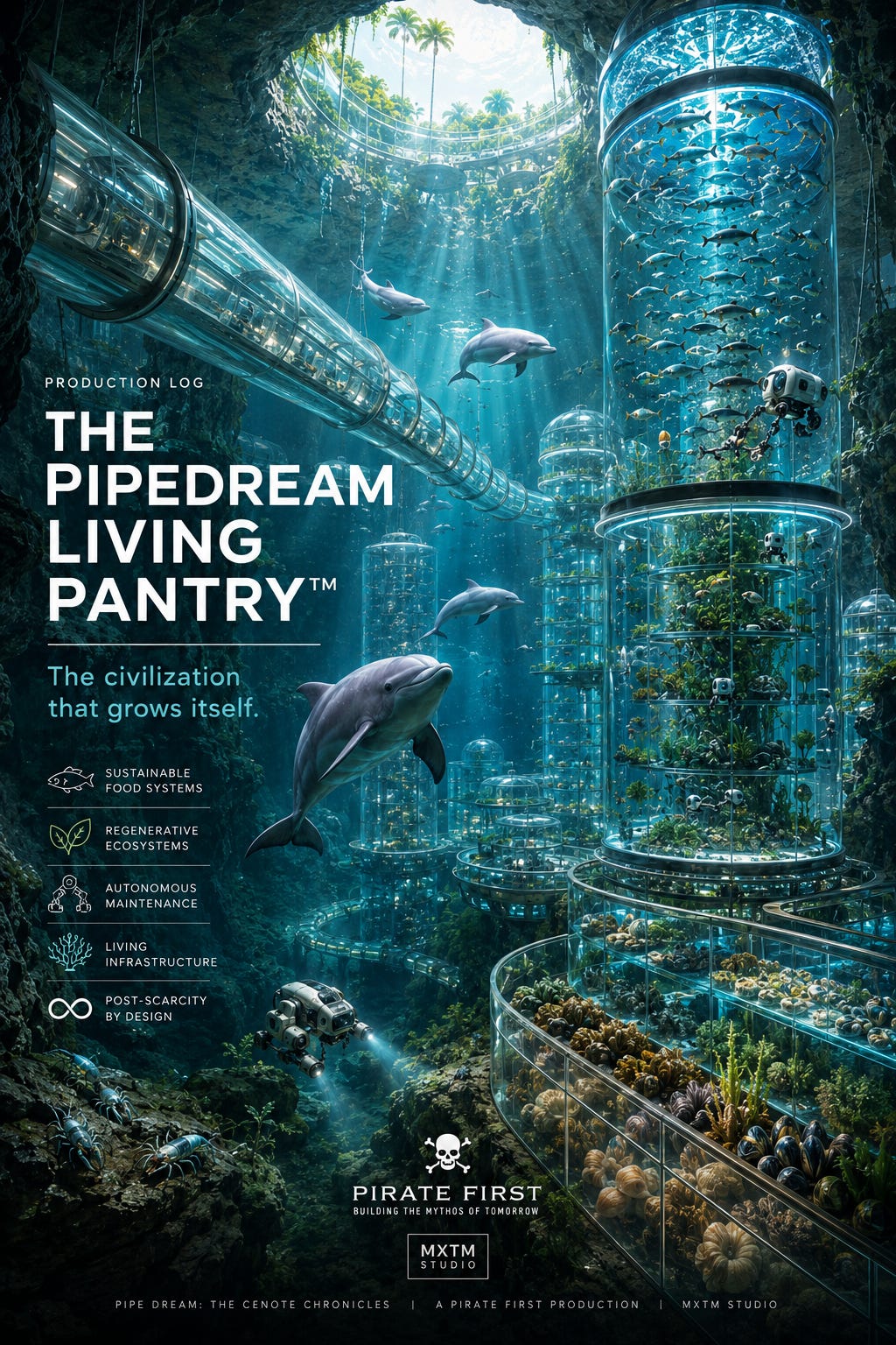
Chapter 1: Floating Villages
The cenote opening is a circle. The founding module is a structure sized to fit through it, assembled below it, anchored beneath it. The founding module’s circular plan dimension — chosen to match the cenote opening’s geometry because aquaforming requires the infrastructure to conform to the formation rather than the formation to conform to the infrastructure — is the civilization’s founding spatial constraint. Everything that the civilization builds within the cenote’s vertical axis respects this constraint: the Crystal Tube sections, the hyper-rise’s gallery rings, the aquaculture city’s cage clusters, the anchor pylon arrays. All sized to what the cenote’s dissolved geometry provides.
The water surface is where this constraint ends.
Above the water table, at the cenote opening’s rim, the limestone does not constrain the plan dimension. The cenote opening is a circle, but the jungle above it extends without boundary. The food forest has been established at the rim, the food forest’s canopy manages the thermal gradient, but the food forest’s plan dimension is not the cenote opening’s plan dimension. The food forest is larger than the opening. The jungle above the food forest is larger still.
The founding module’s surface tier — the atmospheric gallery floating at the freshwater zone’s upper boundary, receiving the daylight column through the cenote opening above it — is the civilization’s first floor. The cenote opening above it is the first floor’s ceiling. The ceiling has a fixed dimension. The first floor cannot exceed it.
The second cenote is a hundred meters from the first.
Between two cenotes, above the water table, in the jungle canopy that neither cenote opening exposes to direct view, there is space. The Crystal Tube network has been bored through the limestone between them, connecting the two freshwater zones, establishing the inter-cenote corridor that Chapter 3 of Part III documented as the founding political act of the regional network. The Crystal Tube runs underground. The jungle above it is the surface. And the surface between two connected cenotes — the limestone substrate between the two openings, at the water table’s depth — is a resource the civilization has not yet claimed.
The floating village is the civilization’s horizontal expansion across this resource: the connected platform network that extends from the founding module’s surface tier through the cenote opening and across the water table’s surface between adjacent cenotes, linking two surface tiers into a contiguous inhabited plane that neither cenote’s circular opening alone could produce.
THE PHYSICS OF THE SURFACE PLANE
The freshwater zone’s upper boundary — the water table’s surface beneath the jungle canopy — is not exposed to the surface world’s atmosphere in a single cenote installation. The cenote opening brings the atmosphere into contact with the water table only at the opening’s plan dimension. The water table extends beneath the limestone in all directions from the cenote, connected to the freshwater aquifer that underlies the full Yucatán Peninsula, but the water table beneath the unperforated limestone is not accessible from above without boring through the limestone to create new access points.
The Crystal Tube’s inter-cenote boring program creates access points in the form of the inter-cenote passage — the tunnel through the limestone whose lower extent is at the freshwater zone’s depth and whose upper extent, where the boring program has created a surface-accessible shaft rather than a horizontal passage, produces a new cenote-like opening to the water table between the two established cenote openings.
The surface-accessible shaft is not a natural cenote. It is the civilization’s deliberate creation of a new opening to the water table between two existing openings — the geological equivalent of the dissolution process that produced the natural cenotes, executed by the Litho-Crustacean boring program’s upward-boring configuration rather than the downward dissolution that geological time produced. The upward-bored shaft creates a circular opening at the jungle surface whose dimensions the boring program’s colony size and the founding charter’s environmental impact specification determine: small enough to minimize the surface disturbance, large enough to allow the floating platform infrastructure to pass through it during installation.
Between two cenote openings, with one or more inter-cenote shafts providing additional access to the water table between them, the water table’s surface in the connection zone between the openings is accessible from above at multiple points. A floating platform that spans the distance between two cenote openings — connecting the founding module’s surface tier at one cenote to the founding module’s surface tier at the other, across the inter-cenote shafts that provide intermediate access — is a floating platform that rests on the water table across the full inter-cenote connection zone’s span.
The water table will carry it. The freshwater zone’s water density, the displacement volume of the platform sections spanning between the access points, and the ballast system’s management of the platform’s neutral buoyancy at each access point together produce the floating platform’s support — the same physics that sustains the founding module’s surface tier, extended across the horizontal span between cenotes rather than concentrated at the single cenote opening.
The floating village is the founding module’s physics applied horizontally: a continuous inhabited plane supported by the water table’s freshwater buoyancy across the full span between connected cenote openings, anchored to the limestone substrate at multiple points along the span, managed by the ballast circuit that the Crystal Tube network’s utility infrastructure connects through the inter-cenote passages.
THE CANOPY PROBLEM
The surface world’s rural settlement occupies the surface it inhabits openly: the buildings are visible from the air, the roads connect them visibly, the agricultural land is the settlement’s spatial context. The surface world’s settlement on the Yucatán’s surface would clear the jungle, expose the limestone, and build on the cleared surface with the materials and methods that the construction industry’s supply chain provides.
PipeDream’s floating village occupies the water table beneath the jungle canopy without clearing the canopy. The canopy problem is not a problem. The canopy problem is an architectural requirement.
The floating platform sections that span between cenote openings and inter-cenote shafts are not visible from the surface world’s aerial observation because the jungle canopy covers them. The platforms’ installation requires passing each component through the cenote opening or the inter-cenote shaft — the aerial delivery protocol’s heavy-lift unit lowering each component through the available opening, the swarm positioning the component at the water table’s surface, the ballast filling the component to neutral buoyancy. The platform expands beneath the canopy, component by component, until the connected plane spans the full inter-cenote connection zone.
The canopy above the spanning platform does not clear. The jungle does not know the platform is beneath it. The ceiba trees whose roots penetrate the limestone to the water table are now in some cases penetrating the limestone adjacent to the floating platform sections’ hulls — the roots reaching the water table alongside the platform rather than through it. The platform’s hull geometry at the root zones is specified to deflect rather than sever the root systems that the food forest’s ecology requires: the hull’s curved surface at the root approach zone angles the roots toward the hull’s perimeter rather than blocking them, allowing the roots to continue to the water table through the hull’s edge zone where the platform’s boundary meets the limestone substrate.
The root deflection is not an engineering challenge that required resolution. It is an ecological requirement that the founding biologists identified in the first season’s food forest monitoring — the observation that some ceiba root systems were approaching the platform hull’s position, and that the hull geometry at these positions would determine whether the root system was severed or deflected. The hull geometry was revised to produce deflection. The root system continues. The food forest’s ecological function is maintained.
This is the aquaforming doctrine at the platform scale: the floating village’s hull geometry is specified to deflect the root systems rather than requiring the root systems to route around the platform. The infrastructure conforms to the biological community. The biological community continues. The platform is beneath the biology, not instead of it.
THE PLATFORM SECTION DESIGN
The floating platform section’s design is the founding module’s surface tier design extended horizontally: the gradient laminate hull material at the surface tier specification — UV-resistant PMMA dominant with the aluminosilicate glass-ceramic outer layer — the ballast system’s ballast tanks distributed across the section’s plan area for lateral stability, the utility connections to the Crystal Tube network’s supply infrastructure through the cenote opening or inter-cenote shaft access points, and the atmospheric management system’s air exchange with the cenote opening’s natural air column.
The platform section’s plan dimension is the inter-cenote connection zone’s geometry — the distance between accessible points where the Crystal Tube’s inter-cenote passage creates the shaft access to the water table, and the founding module’s surface tier’s plan dimension at each end. The plan dimension varies by installation: cenotes that are close together with a direct-line inter-cenote passage produce platform sections whose span is shorter and whose plan is more compact; cenotes that are further apart with multiple intermediate shafts produce platform sections that span larger distances across the water table with intermediate support at each shaft access point.
The platform section’s structural system is the same structural system as the founding module’s surface tier: the hyper-rise’s circular column-and-beam framework at each access point, providing the vertical structural connection between the floating platform’s surface plane and the Crystal Tube network below the water table, with the horizontal plane’s structural demands managed by the ballast system’s load distribution across the plan area.
The ballast system’s load distribution is the platform section’s most important structural contribution: the freshwater buoyancy that supports the platform is distributed across the full plan area’s displacement volume, not concentrated at the access points where the Crystal Tube connections provide vertical structural connection. The distributed buoyancy produces a floating plane whose load path is not the surface world’s beam-and-column structure transmitting loads to discrete foundation points — it is the distributed pressure of the water table’s buoyancy against the platform section’s full underside, producing a structural behavior closer to the surface world’s mat foundation than to its conventional column grid.
The mat foundation analogy is imprecise — the platform is floating on the water table rather than resting on the earth — but the structural distribution logic is comparable: the loads are spread across the full supported surface rather than concentrated at discrete points. The consequence is that the platform section can accept point loads — the temporary concentrated load of a food delivery staging area, the permanent concentrated load of a vertical Crystal Tube connection to the hyper-rise below — without requiring the structural provision for concentrated loads that the surface world’s beam-and-column structure’s design philosophy demands at every column location.
The distributed buoyancy is the formation’s structural gift. The water table supports the full surface. The platform accepts the support without concentrating the load at points the formation must provide specific geological stability for.
THE VILLAGE’S SOCIAL TOPOLOGY
A floating village is not a floating building. The distinction matters for the same reason that the surface world’s urbanists have argued it matters in the terrestrial context: a building is a single occupied structure whose inhabitants share a common roof and a common floor and a common relationship to the structure’s exterior. A village is multiple occupied structures whose inhabitants share a commons — a public space, a circulation network, a shared resource infrastructure — without necessarily sharing any individual structure.
The floating village’s commons is the water table’s surface between the platform sections: the zone that is below the jungle canopy but above the freshwater zone, that connects the platform sections without being incorporated into any platform section, that is accessible to the cycle-sub approaching from the Crystal Tube network below and to the food forest’s edge activity approaching from the cenote rim above. The commons is the village square, floating at the water table’s surface, enclosed by the jungle canopy above and the freshwater zone below, bounded by the platform sections at its edges and the cenote openings at its ends.
The platform sections are the village’s private and semi-private zones: the accommodation sections where the enrolled longevity program participants sleep, the research sections where the installation’s scientific program operates, the governance sections where the REDEEMR framework’s council meets, the processing sections where the aquaculture harvest is sorted and packaged. Each section has its own function, its own atmospheric management specification, its own access protocol. The commons is the space between them.
The commons’ character is determined by what the formation provides: natural daylight from the cenote opening’s column at the ends, diffused light from the jungle canopy’s filtered solar transmission across the middle, the freshwater zone’s biological community visible through the commons’ transparent hull section at the water table’s surface, and the breeze through the cenote openings’ air exchange with the jungle’s atmosphere. No engineered spectacle. No designed experience. The formation’s conditions at the water table’s surface between two connected cenotes.
The village’s social life is the life of people who share the formation’s conditions as the commons between them. Not the formation as a backdrop — the formation as the space they share. The commons is not designed to produce community. The commons is the formation at the water table’s surface, and people who inhabit the same formation at the same surface develop the community that shared conditions produce over time.
The surface world’s urban design has argued about this for two centuries: whether the designed public space produces community or whether community produces the use of public space. The floating village’s commons is not designed to produce community. It is the formation’s water table surface, present at the village’s center, available to the village’s inhabitants because the platform sections are on either side of it and the Crystal Tube connections are below it. Whether community develops there is the village’s inhabitants’ matter. The commons provides the space. The formation provides the conditions. The community is what the inhabitants make of both.
ANCHORING THE VILLAGE
The floating village’s anchor system is more complex than the founding module’s anchor system because the floating village’s span between cenote openings crosses a limestone substrate whose geological character varies across the inter-cenote distance. The founding module’s anchor pylons were specified for the founding cenote’s specific limestone stratigraphy, characterized through the hydroprint campaign’s acoustic surveys and confirmed through the anchor sequence’s ground-penetrating sensor returns. The floating village’s anchor points — at each inter-cenote shaft’s access point, at the founding module’s existing anchor positions at each cenote, and at intermediate points where the platform section’s span length requires intermediate support against the current events the underground river system produces — cross multiple limestone zones whose stratigraphy the inter-cenote boring program’s transceiver chain surveys have characterized at varying spatial resolution.
The anchor specification for each intermediate point is derived from the inter-cenote boring program’s acoustic characterization of the limestone at that point — the transceiver chain’s forward detection of the limestone’s stratigraphy ahead of the boring program’s advance provides the pre-anchor characterization that the hydroprint campaign provides for the founding module’s anchor positions. The pre-anchor characterization is less detailed than the hydroprint — the boring program’s transceiver chain characterizes the stratigraphy at one meter spatial resolution from the boring direction rather than the hydroprint’s full three-dimensional acoustic survey — but it is sufficient to specify the anchor’s initial target depth and the hydraulic ram’s force calibration for the ground-penetrating sensor’s real-time adjustment during driving.
The real-time adjustment during driving is more important for the intermediate anchor points than for the founding module’s anchor positions, because the inter-cenote limestone’s stratigraphy between the cenote openings is less precisely characterized than the cenote’s immediate vicinity limestone — the founding module’s anchor positions are in the limestone that the cenote’s dissolution history has been most active in, and active dissolution history produces a more geologically legible stratigraphy than the inter-cenote limestone’s less-dissolved zones. The inter-cenote limestone is more competent — more structurally consistent, less fractured, less dissolution-altered — than the cenote-vicinity limestone. More competent limestone requires more driving force to anchor but provides more consistent load distribution once the anchor is seated.
The anchor sequence’s ground-penetrating sensor in the more competent limestone produces cleaner stratigraphic returns — the stratigraphy’s structural consistency produces acoustic returns that the geological model interprets with higher confidence than the cenote-vicinity limestone’s dissolution-altered stratigraphy. The anchor specification’s adjustment during driving is smaller in the competent limestone — the sensor confirms the pre-anchor characterization more consistently, requiring less real-time adjustment. The inter-cenote anchors are more straightforward to drive despite the greater depth of precise characterization that the hydroprint’s three-dimensional survey provides at the cenote vicinity.
The village’s full anchor system — the founding module’s original anchor array at each cenote, the inter-cenote shafts’ anchor connections, and the intermediate anchor points across the platform section’s span — is the first infrastructure in the PipeDream network whose anchor load path crosses multiple geological zones characterized by different methods at different spatial resolutions. The coordinating system’s structural health monitoring layer maintains the full anchor integrity model across all zones simultaneously, reconciling the different characterization methods’ confidence intervals in the combined structural assessment that the Terraform Operator’s morning monitoring review presents as a unified anchor integrity map.
The unified anchor integrity map is the village’s structural status report: the combination of the founding module’s long-established anchor integrity data, the inter-cenote shaft’s medium-resolution characterization data, and the intermediate anchor point’s transceiver chain characterization data, integrated into a single structural confidence assessment that the coordinating system updates at every monitoring interval and that the Terraform Operator’s professional judgment evaluates at every morning review.
The village’s structural integrity is a geological literacy requirement. The Terraform Operator who monitors the floating village’s anchor integrity must be able to read the unified map’s multi-source confidence gradients — the different confidence colors that represent the different characterization methods’ resolution — and make the professional judgment that integrates the geological model’s quantitative analysis with the Terraform Operator’s direct observational knowledge of the limestone’s visible condition at the cenote rim and the inter-cenote shaft access points. The judgment is not algorithmic. The unified map provides the data. The Terraform Operator provides the interpretation.
THE TRIAL WINDOW FOR HORIZONTAL EXPANSION
The founding module’s trial window was twelve months — the minimum period required to observe the founding cenote’s freshwater zone through a full seasonal cycle before committing the anchor sequence. The floating village’s horizontal expansion across the inter-cenote connection zone does not have a twelve-month trial window in the same sense: the founding module’s surface tiers at each cenote have been established and anchored, the inter-cenote Crystal Tube connection has been installed and commissioned, and the floating platform sections’ installation is not installing a new habitation unit in a new geological zone — it is extending an existing habitation unit across the connection between two already-inhabited zones.
The trial window’s logic at the founding module stage was the information deficit: the coordinating system’s formation model before the founding module’s installation was a hydroprint prediction rather than an operational observation, and the twelve months converted the prediction into the observation that the anchor commitment required. The floating village’s horizontal extension stage does not have an equivalent information deficit at the platform section’s position: the inter-cenote boring program’s acoustic characterization, the Crystal Tube installation’s commissioning survey, and the regional network’s halocline monitoring from both founding cenotes have characterized the inter-cenote connection zone’s formation conditions at sufficient resolution for the platform section installation to proceed without the founding module’s twelve-month trial window.
The trial window’s replacement is the platform section’s neutral buoyancy observation period: a shorter period — typically four to six weeks — during which each platform section achieves neutral buoyancy in the water table between the cenote openings, the ballast system’s seasonal calibration is confirmed against the halocline sensor network’s current depth data, and the anchor sequence’s ground-penetrating sensor characterization is performed at each anchor point before driving. The four-to-six-week observation period is not the founding module’s twelve-month trial window. It is the reduced observation period that the prior characterization and the established regional formation model justify.
The trial window compression that Chapter 5 of Part II documented for successive tiers of the same cenote’s hyper-rise applies equally to the floating village’s horizontal expansion across the established network: the foundation model has been established. The founding cenotes’ seasonal behavior is known. The inter-cenote limestone’s stratigraphy has been characterized. The platform section’s installation can proceed at the pace that the reduced observation period’s confidence level justifies.
The patience the founding generation invested in the founding module’s twelve-month trial window is the reason the subsequent platform sections’ installation can proceed at the four-to-six-week pace. The patience purchased the confidence. The confidence produces the speed. The floating village grows at the speed the founding patience earned.
THE VILLAGE’S RELATIONSHIP TO THE SURFACE
The floating village is the civilization’s closest approach to the surface world. Not physically — the surface is thirty to fifty meters above the water table where the platform sections float, depending on the limestone depth between the jungle surface and the freshwater aquifer. But economically, the floating village is the civilization’s primary interface with the surface world’s supply chains.
Everything the founding module required for construction arrived through the cenote opening — the heavy-lift unit’s aerial delivery, the swarm’s assembly below the opening, the component supply chain from the surface world’s manufacturing through the jungle canopy’s aerial access point. The floating village’s horizontal span between cenotes creates additional aerial access points — the inter-cenote shafts’ surface openings — that the heavy-lift unit can use for delivery. Multiple delivery points reduce the dependency on any single cenote opening’s access geometry, allowing the construction supply chain to manage the delivery sequence across multiple simultaneous openings.
The multiple delivery points also create the foundation for the floating village’s most important supply chain independence: the food forest’s food production. The food forest at each cenote rim is a managed succession ecology whose quarterly biomass survey and seasonal harvest provide fresh food to the installation’s residents and enrolled participants. The floating village’s platform sections beneath the food forest create the food forest’s harvested material’s processing and distribution point — the harvest can be delivered directly from the cenote rim to the platform section below without the aerial transit that delivering to the sub-halocline installation requires.
The food forest’s harvest arrives at the platform section’s surface-tier processing gallery without leaving the cenote’s ecological zone — the harvest moves vertically through the cenote opening from the rim’s food forest to the platform section below. The vertical supply chain is the floating village’s most efficient logistics path and the one that most completely realizes the founding charter’s closed-loop economics vision: the installation’s black water digestate fertilizes the food forest through the irrigation header, the food forest’s harvest feeds the installation through the vertical supply chain, and the loop closes at the platform section’s processing gallery where the harvest becomes the food that the longevity program participants and permanent residents eat.
The vertical supply chain replaces the inter-cenote transit logistics for the local food supply: the Living Pantry Corridor cenote’s aquaculture production supplements the floating village’s food system, but the food forest’s local harvest provides the foundation that the vertical supply chain’s efficiency makes the cheapest and freshest supply source. The floating village’s proximity to the food forest’s production is the surface world’s farm-to-table concept implemented as a vertical supply chain through the cenote opening — the farm is at the rim, the table is on the platform section, the supply chain is the cenote opening’s vertical access.
WHAT THE VILLAGE LOOKS LIKE FROM THE JUNGLE
The floating village, from the jungle’s surface, looks like a cenote with a different light. The cenote openings at each end of the village’s span show the downwelling glow that the light relay’s operation produces in any occupied cenote installation. The inter-cenote shafts — the additional openings that the boring program created between the cenote openings — show the same glow at smaller scale: circular patches of lit interior visible through the jungle canopy’s breaks at the shaft positions.
A sequence of lit circles in the jungle canopy, separated by the inter-cenote distances that the Chicxulub arc’s fracture geology has produced between cenote openings in this specific zone, is the floating village’s aerial signature. Not a village in any form the surface world recognizes: no walls, no rooftops, no streets, no infrastructure visible above the canopy. A pattern of lit circles, glowing upward through the jungle from the water table below.
The pattern is the floating village’s surface expression. The village is below the pattern, on the water table, in the aquifer’s uppermost zone, connected by the Crystal Tube network through the limestone, managed by the coordinating system through the sensor infrastructure, inhabited by the longevity program’s enrolled participants and the installation’s permanent residents and the visiting adventure program’s guests, producing the food chain and the research commons and the governance function that the founding charter assigned to the regional network.
The jungle does not know it is covering a village. The village does not require the jungle to know. The village is the aquifer’s uppermost expression. The jungle is the surface world’s lowest expression. They occupy the same vertical zone in the Yucatán’s geological stack — the jungle’s root zone and the aquifer’s surface — without one displacing the other.
This is the floating village’s most precise expression of the aquaforming doctrine’s deepest claim: not that the civilization has fit inside the formation without disturbing it, but that the civilization and the formation occupy the same zone simultaneously without either requiring the other to yield. The formation occupies the limestone, the aquifer, the water table, the cenote openings, the jungle above. The civilization occupies the water table between the cenote openings, the Crystal Tube network in the limestone, the platform sections on the aquifer’s surface, the food forest at the cenote rim. They are in the same zone. Neither has moved for the other.
The floating village does not fit inside the formation. The floating village is part of the formation — the inhabited expression of the formation’s water table surface between cenote openings, managed by the civilization’s intelligence, supported by the formation’s freshwater buoyancy, connected to the formation’s limestone substrate through the anchor pylons, fed by the formation’s geology through the food forest’s mycorrhizal network and the ballast circuit’s closed loop.
The village floats on the aquifer. The aquifer is the village’s foundation. The foundation has been there sixty-six million years.
THE TRIAL VILLAGE
The founding charter’s expansion protocol specifies the first floating village as a design validation — not a population accommodation, not a revenue expansion, not a governance statement, but a test of the horizontal expansion’s physics and logistics at the scale of two connected cenotes with one inter-cenote shaft access point.
The trial village’s design is minimal: two platform sections, one at each founding cenote’s surface tier, connected by a single inter-cenote connection section crossing above the Crystal Tube passage that connects the two freshwater zones, with the inter-cenote shaft providing the connection section’s intermediate support and aerial access. Three platform sections total. One commons, defined by the connection section between the two cenote sections. Two founding cenotes’ surface tiers extended by one inter-cenote connection.
The trial village’s population is the founding cenotes’ existing enrolled participants and permanent residents — the same people who have been inhabiting the founding module’s surface tiers. The trial village does not increase the population. It extends the inhabited plane across the water table between the two cenotes, giving the existing population access to the commons that the connection section creates.
The trial village’s validation criteria are the horizontal expansion’s three physics requirements: the platform sections achieve stable neutral buoyancy across the full seasonal halocline cycle without the ballast system’s intervention frequency exceeding the specification; the inter-cenote connection section’s anchor points maintain integrity across the seasonal underground river system’s full hydraulic range; and the commons’ natural air exchange through the two cenote openings maintains the atmospheric CO₂ within the comfort range without the atmospheric management system’s supplementary scrubbing.
All three criteria address the unknowns that the trial period must resolve — the physics of the horizontal expansion across the inter-cenote connection zone that no previous installation has tested. The founding module’s trial window resolved the unknowns for the vertical expansion into the freshwater zone. The trial village’s validation period resolves the unknowns for the horizontal expansion across the water table between connected cenotes.
When the validation criteria are satisfied — when the monitoring confirms that the neutral buoyancy is stable, the anchors are holding, and the air exchange is sufficient — the trial village becomes the reference design for the regional network’s full floating village program. The reference design is the template from which every subsequent floating village’s design departs at the cenote-specific distances and shaft-specific access points that each connection zone’s geology determines.
The trial village is the proof. The reference design is what the proof makes possible. The floating village network is what the reference design scales to.
THE VILLAGE NETWORK
The regional network’s floating village program is not a single village at a single pair of connected cenotes. It is the horizontal expansion plan that the regional network’s full connection topology supports: every inter-cenote connection that the Crystal Tube Standard has established between Formation cenotes and Corridor cenotes is a potential floating village’s substrate. The platform sections that span each inter-cenote connection zone create the continuous inhabited plane that connects the regional network’s cenote hubs into a village network whose total plan area is the sum of all the inter-cenote connection zones’ water table surfaces.
The village network’s total plan area is not determined by the founding engineers’ planning decisions. It is determined by the Chicxulub arc’s fracture geology — by the cenote distribution that sixty-six million years of dissolution has produced and that the regional network’s Crystal Tube installation has connected. The fracture geometry determines where the cenotes are. The cenote distribution determines the inter-cenote connection zones. The connection zones’ water table surfaces are the village network’s potential extent.
The civilization occupies the potential that the geology produced. Not all of it simultaneously — the expansion planning sequence that the coordinating system’s formation readiness signal and the Terraform Operator’s concurrent authorization govern applies equally to the floating village program’s horizontal expansion as to the vertical expansion within each cenote’s hyper-rise. Each platform section’s installation is governed by the formation readiness signal at the inter-cenote connection zone’s anchor points.
But the potential is the geology’s gift. The floating village network’s total extent is the sum of all the cenote-to-cenote water table spans that the regional network’s Crystal Tube installation has connected. The civilization navigates toward that total extent at the pace the formation allows.
The pace is patient. The potential is large. The village grows.
Cross-references: Part I, Ch. 4 (Floating Before Anchoring); Part II, Ch. 5 (Growing One Module at a Time); Part III, Ch. 3 (Linking Cenote to Cenote); Part III, Ch. 6 (The First Regional Network); Part IV, Ch. 2 (Autonomous Construction); Part VIII, Section A, Ch. 4 (From Resort to Municipality); Part VIII, Section A, Ch. 5 (The Economics of Infinite Expansion); Part IX, Ch. 2 (Floating Title and the Habitation Record). For floating platform section hull material specification and ballast system configuration for surface-tier horizontal expansion, see Appendix D (Construction Operations Manual). For inter-cenote shaft boring configuration and surface access aperture specification, see Appendix D (Construction Operations Manual). For trial village validation criteria and reference design derivation protocol, see Appendix D (Construction Operations Manual). For horizontal expansion anchor specification using inter-cenote boring program transceiver chain characterization data, see Appendix A (Formation Baseline Protocol). For food forest vertical supply chain logistics integration with surface-tier processing gallery, see Appendix F (Biological Operations Manual).
PIPE DREAM
PART VIII — THE EXPANDING CIVILIZATION
Section A: The Founding Formation
Chapter 2: Anchored Towers
The hyper-rise was the first anchored tower. Its structural logic — the Crystal Tube column descending from the surface tier’s floating module through the freshwater zone’s depth to the anchor pylons’ limestone connection, the gallery rings expanding the occupied floor area at each depth tier, the biological and mechanical maintenance systems servicing the assembled structure through the combined infrastructure of the Crystal Tube Standard’s supply lines — was established in Part II’s six chapters as the architectural and engineering foundation from which the civilization’s vertical extent grows.
But the hyper-rise is an inward tower. It descends from the surface tier into the cenote’s geological depth. Its expansion is downward into the formation’s stratified ecology, toward the Chemostat’s industrial metabolism at the anoxic boundary. The hyper-rise is the civilization’s exploration of what the formation contains below the founding module’s floor.
The anchored tower documented in this chapter is an outward tower. Not upward — upward from the floating village’s water table surface into the jungle’s atmosphere, above the cenote opening’s rim, into the surface world’s visual field, is the one direction the aquaforming doctrine most directly prohibits. A tower visible from the jungle’s surface would be a tower that has broken the canopy — that has claimed the surface world’s visual field for itself rather than remaining inside the formation’s geological context. The civilization does not break the canopy.
The anchored tower is a lateral tower: a structure that extends horizontally from the floating village’s platform sections into the inter-cenote connection zone’s water table volume, expanding the inhabited floor area not by growing downward into the hyper-rise’s depth stratification and not by growing upward into the surface world’s visual field, but by growing outward across the water table’s surface between the cenote openings that the floating village platform has already established.
The anchored tower is the floating village’s vertical supplement: where the floating village’s platform sections provide a horizontal inhabited plane at the water table’s surface, the anchored tower provides the structural connection between that horizontal plane and the limestone substrate below it — the connection that converts the floating platform from a buoyant surface into a fixed inhabited structure with multiple inhabited levels extending from the surface tier’s floating plane downward through the freshwater zone to the depth the anchored tower’s structural specification reaches.
WHAT AN ANCHORED TOWER IS
The anchored tower begins at the floating village’s platform section — the horizontal plane at the water table’s surface that Chapter 1 established as the civilization’s horizontal expansion mechanism. The platform section’s structural framework includes the vertical Crystal Tube columns that the hyper-rise’s gallery ring system uses to organize depth tiers below the founding module. In the floating village’s platform sections, these vertical columns are present at the inter-cenote shaft’s access points — the connections through which the heavy-lift unit delivers components and through which the Crystal Tube network’s utilities are connected to the platform’s surface tier.
The anchored tower extends the vertical Crystal Tube columns from the inter-cenote shaft’s access point downward through the water table into the freshwater zone below the platform section, adding gallery rings at successive depth tiers that expand the inhabited floor area at each depth into the freshwater zone’s three-dimensional volume beneath the platform section’s surface plane. The gallery rings at each depth tier are the same gallery ring architecture as the founding cenote’s hyper-rise — the Crystal Tube columns connected by horizontal gallery sections at each depth, the biological and mechanical maintenance systems servicing the assembled rings, the therapeutic atmospheric management providing the longevity protocol’s pressure and nitrox specification at each depth tier’s assigned therapeutic range.
The critical difference from the founding cenote’s hyper-rise is the geological substrate. The founding cenote’s hyper-rise descends into the founding cenote’s geological void — the cenote’s dissolved interior volume where the freshwater zone, halocline, and anoxic zone are accessible as a pre-existing three-dimensional geological space. The anchored tower descends into the inter-cenote connection zone’s limestone — the competent, less-dissolved, structurally consistent limestone that the inter-cenote boring program’s transceiver chain characterized as the geological zone between the two cenote openings.
The anchored tower is not in a cenote. It is in the limestone between cenotes.
This distinction is the anchored tower’s architectural novelty and its primary engineering challenge: the founding cenote’s hyper-rise was built in a space that the formation’s dissolution had already opened. The anchored tower is built in a space that the civilization must open — the Litho-Crustacean boring program’s upward-and-outward boring from the inter-cenote passage creating the vertical shaft volume that the anchored tower’s gallery rings will occupy.
BORING UPWARD
The standard Litho-Crustacean boring configuration advances horizontally through the limestone — the inter-cenote passage boring that Part III documented and Part IV’s Chapter 5 analyzed in full biological and mechanical detail. The anchored tower’s creation requires the boring program’s vertical configuration: the colony advancing upward through the limestone from the inter-cenote passage’s established Crystal Tube network, creating the vertical shaft that the anchored tower’s structure will occupy.
The upward boring configuration presents the boring colony with its gravitationally most demanding orientation: the calcium carbonate debris that the acoustic cavitation fractures at the bore face falls downward, toward the colony, rather than away from the colony as in the horizontal configuration. The colony’s feeding appendages, which sweep the bore face’s fractured material into the digestive system, must work against the debris’s gravitational settling rather than with it.
The coordinating system’s upward boring colony management protocol addresses this through two adjustments from the horizontal boring protocol. First, the boring session duration is reduced — the colony’s metabolic effort in the upward configuration is higher than in the horizontal configuration because the debris management requires additional mechanical work against gravity. The shorter session duration reduces the accumulated fatigue per session, maintaining the boring appendage’s repair cycle’s effectiveness in the more demanding orientation. Second, the advance rate is reduced proportionally — the colony advances more slowly in the upward configuration, and the coordinating system’s advance rate instruction reflects the gravitationally limited output rate that the upward configuration produces.
The paste output in the upward boring configuration is applied to the shaft’s wall rather than the bore’s ceiling — the freshly fractured limestone that the boring appendage’s acoustic cavitation has exposed on the shaft’s cylindrical wall is accessible to the colony’s posterior paste apertures without the gravitational disadvantage that the debris collection presents. The paste application seals the shaft wall as the colony advances upward, and the sealed shaft wall provides the structural continuity that the shaft’s eventual Crystal Tube installation requires — the same paste-sealed wall that the horizontal boring produces, applied in the vertical orientation.
The upward boring’s advance rate is slower than the horizontal boring’s. The vertical shaft that the anchored tower requires — typically fifteen to twenty meters of freshwater zone depth between the inter-cenote passage and the platform section’s underside — is completed in a longer boring period than an equivalent horizontal passage length would require. The additional boring time is the anchored tower’s installation overhead compared to the horizontal expansion’s floating platform sections — the cost of creating the space the anchored tower occupies rather than installing into a space the formation has already created.
The overhead is acceptable within the expansion program’s patience: the anchored tower is a long-term investment in the inter-cenote connection zone’s inhabited density, adding freshwater zone therapeutic depth to the floating village’s horizontal plane. The boring period is the investment’s construction phase. The therapy hours that the anchored tower’s depth-stratified gallery rings provide are the investment’s operational return. The return compounds across the longevity program’s enrolled participant population for the full design life.
THE STRUCTURAL CASE FOR ANCHORING
The floating village’s platform sections are buoyant — they rest on the water table’s surface because the ballast system maintains their neutral buoyancy at the water table’s depth. The ballast system is active: it manages the ballast circuit’s fill and drain cycles in response to the halocline’s seasonal migration, the underground river’s flood events, and the platform section’s variable load from the enrolled population’s movements across the platform’s plan area.
The active ballast management is adequate for the platform section’s floating operation across the full seasonal range that the regional formation model predicts. But active management has a failure mode: the ballast system’s active components — the pumps, the valves, the sensors — are electrically powered, and the Blackout Protocol’s full power failure condition takes the active ballast management offline simultaneously with the other electrically powered systems.
In the Blackout Protocol’s power failure condition, the platform section’s buoyancy is determined by the ballast tanks’ current fill state at the moment of power failure — whatever state the active management maintained at the failure’s onset. If the water table’s depth has shifted since the last active management cycle — if the flood event’s water table rise began after the Blackout Protocol’s onset rather than before — the platform section’s buoyancy state at the power failure’s onset may not be appropriate for the water table’s current depth.
The anchored tower’s anchor pylon connection to the limestone substrate addresses this vulnerability: the anchor pylons’ physical connection holds the anchored tower’s structure at its designed depth relative to the limestone substrate regardless of the ballast system’s operational state. The limestone does not rise with the water table. The anchored tower anchored to the limestone remains at its designed depth while the water table’s surface rises or falls around it. The anchored tower is depth-stable without active ballast management.
The depth stability is the structural case for anchoring. The floating village’s platform sections have ballast-managed depth stability across normal operational conditions. The anchored tower has anchor-stabilized depth stability regardless of the ballast system’s operational state. The anchored tower is the safety architecture’s structural provision for the vertical dimension — the complement to the Blackout Protocol’s passive provisions for the atmospheric and navigation dimensions.
The anchor pylon at the anchored tower’s base is in the inter-cenote limestone that the upward boring program created the shaft through. The limestone’s geological characterization from the boring program’s transceiver chain survey — the stratigraphy that the boring advance’s ground-penetrating acoustic sensor mapped — is the anchor specification’s foundation. The anchor sequence drives the pylon into the limestone below the shaft’s base at the depth and force that the transceiver chain’s characterization identified as the competent zone for the design anchor load. The fast-cure polymer grout fills the annulus behind the pylon tip. The cure period is the founding charter’s anchor commitment period.
The anchored tower’s anchor commitment is the horizontal expansion program’s most consequential structural decision: the commitment converts the floating platform section at the shaft’s surface entry from a buoyant structure into a fixed structure — a structure whose depth position is determined by the anchor’s limestone connection rather than by the ballast system’s active management. The conversion is irreversible: the anchor cannot be removed without fragmenting the limestone around the grout-filled annulus. The anchored tower is permanent at its anchored position.
This permanence is the anchored tower’s most important distinction from the floating platform section — and it is the reason that the founding charter’s anchor commitment protocol applies the same Terraform Operator concurrent authorization requirement that the founding module’s anchor commitment required. The anchored tower’s anchor commitment is as consequential as the founding module’s: the civilization is committing to a permanent structure at this position in this geological zone. The formation must have indicated readiness for this commitment at this position. The Terraform Operator’s professional judgment must concur.
GALLERY RINGS IN COMPETENT LIMESTONE
The anchored tower’s gallery rings occupy the vertical shaft that the upward boring program created in the inter-cenote limestone. The gallery rings’ structure is the same gallery ring architecture as the founding cenote’s hyper-rise — the Crystal Tube column-and-ring framework at each depth tier. But the geological context is different: the hyper-rise’s gallery rings are in a dissolved void whose walls are the cenote’s natural limestone surfaces, colonized by the synthetic reef community and managed by the biological maintenance protocol. The anchored tower’s gallery rings are in a bored shaft whose walls are the boring colony’s paste-sealed limestone surface — the same paste-sealed character as the inter-cenote passage’s walls, present at the vertical orientation.
The paste-sealed shaft wall is not a natural cenote surface. It is the boring program’s geological product: a surface whose chemistry and microstructure reflect the boring colony’s calcium carbonate paste output rather than the natural cenote’s dissolution history. The paste-sealed surface has the same structural character as the bore’s sealed surface — consolidated, chemically stable, mechanically regular — but it does not have the cenote’s visual character: no stalactites, no dissolution formations, no geological history expressed in the surface’s texture.
The anchored tower’s gallery rings are inside a smooth, paste-sealed cylindrical shaft rather than inside the visually complex geological void that the founding cenote’s hyper-rise occupies. The visual environment through the gallery ring’s Crystal Tube hull is not the aquifer’s geological complexity — it is the paste-sealed shaft wall at close range. The anchored tower is not the Underground Safari’s geological spectacle. It is the therapeutic environment’s pressure chamber: a precisely managed depth position at the therapeutic pressure range, inside a structurally stable geological shaft, with the atmospheric management’s nitrox specification and the medical monitoring’s weekly bloodwork assessment as the primary experiential infrastructure.
The visual environment through the anchored tower’s Crystal Tube hull is not the attraction. The therapeutic pressure at depth is the attraction. The longevity program’s enrolled participants who are assigned to the anchored tower’s depth positions have been assigned there for the therapeutic benefit that the depth provides — the bloodwork’s evidence that this depth’s pressure and oxygen partial pressure are producing measurable biological impact in the direction the protocol targets. The visual environment through the hull is what the paste-sealed shaft wall provides at close range: the limestone’s compressed calcium carbonate structure, uniform in texture, faint in color, geologically undramatic.
The coordinating system’s light relay operates through the anchored tower’s Crystal Tube sections as through any section in the network — the total internal reflection propagation transmits the surface tier’s illumination through the shaft’s column infrastructure to the gallery rings at each depth tier, providing the photosynthetically active output that the therapeutic protocol’s circadian management requires. The gallery rings are illuminated by the relay. The illumination reveals the paste-sealed shaft wall’s geology at whatever visual resolution the current illumination intensity provides.
The paste-sealed shaft wall’s geological character — compressed calcium carbonate, faint trace mineral inclusions, the boring colony’s paste output’s crystal microstructure — is not the founding cenote’s geological drama. But it is honest geology: the physical reality of the inter-cenote limestone that the boring program created the shaft through, present at the gallery ring’s hull distance, available to the enrolled participant’s direct observation if the participant chooses to observe it.
The participant who has studied the biological succession in the founding cenote’s hyper-rise through the Crystal Tube’s transparent hull — who has watched the synthetic reef’s mid-succession community evolve through the cleaning cycle’s management — and who is now in the anchored tower’s gallery ring looking at the paste-sealed shaft wall is looking at the biological community’s absence. The shaft wall has been sealed too recently for the biological succession to have established at the mid-succession stage that the founding cenote’s installed surfaces have reached. The paste-sealed surface is in the pioneer stage — the conditioning film phase, the first bacterial adhesion beginning, the early succession community weeks or months from the mid-succession stage that the Ancistrus vitreus cleaning cycle targets.
The anchored tower’s gallery rings’ biological community is young relative to the founding cenote’s hyper-rise’s community. The pioneer stage’s ecological poverty is honest: the shaft was bored recently. The community is at the stage the time since installation allows. The ecology does not pretend to be older than it is.
THE THERAPEUTIC TOPOLOGY OF THE TOWER
The anchored tower’s gallery rings are assigned to the longevity program’s enrolled participants by the same protocol that assigns the founding cenote’s hyper-rise’s gallery positions: the coordinating system’s medical monitoring layer’s weekly bloodwork assessment identifying the therapeutic pressure range that each participant’s biological profile indicates will produce the most significant response in the next weekly period, and the Terraform Operator’s concurrent recommendation confirming that the assessment’s depth assignment is appropriate for the participant’s current physiological state.
The anchored tower’s depth range — fifteen to twenty meters below the floating village’s surface tier platform section — spans the freshwater zone’s upper therapeutic range: approximately 1.15 to 1.20 atmospheres at the anchored tower’s shallowest gallery rings, increasing toward the 1.3 to 1.4 atmosphere range at the tower’s deepest gallery rings near the shaft’s base. This range is the longevity program’s entry-level therapeutic range — the pressure that produces measurable therapeutic response in participants whose biological baseline and physiological state indicate that the deeper ranges of the founding cenote’s hyper-rise would be premature or counterproductive.
The anchored tower’s therapeutic topology completes the regional network’s pressure stratification: the floating village’s surface platform is at 1.0 atmospheres — orientation, day visitors, adventure program guests. The anchored tower’s upper gallery rings are at 1.15 to 1.20 atmospheres — longevity program enrollment’s first weeks, the early pressure acclimation phase. The anchored tower’s lower gallery rings are at 1.25 to 1.30 atmospheres — the therapeutic response’s initial measurement phase. The founding cenote’s hyper-rise’s gallery rings are at 1.30 to 1.50 atmospheres — the sustained therapeutic phase whose week-four bloodwork typically confirms the telomere extension the protocol targets. The deep gallery’s research accommodation is at 1.50 to 2.00 atmospheres — the permanent residents’ long-term saturation.
The pressure stratification across the regional network’s full inhabited infrastructure — from the surface tier’s 1.0 atmospheres to the deep gallery’s 2.00 atmospheres — is the longevity program’s therapeutic ladder: the progression through which the enrolled participant moves across the enrollment period from the initial orientation through the graduated therapeutic pressure exposure to the depth assignment that the bloodwork confirms produces the biological impact the protocol targets.
The anchored tower is the ladder’s lower rungs — the pressure range where the enrollment begins and where the biological response’s early indicators establish the protocol’s direction. The anchored tower is where the enrolled participant discovers what their biology does with therapeutic pressure: whether the early response is strong, indicating that the protocol’s deeper ranges will produce proportionally greater response, or modest, indicating that the protocol’s management should proceed with patience before advancing to greater depth.
The anchored tower’s gallery rings are the longevity program’s most frequently accessed depth positions — the positions through which every enrolled participant passes in the protocol’s progression, regardless of where the bloodwork eventually places them on the therapeutic ladder’s higher rungs. The founding cenote’s hyper-rise’s deeper gallery rings are accessed by the participants whose bloodwork confirms the deeper range’s benefit. The anchored tower’s gallery rings are accessed by everyone who enrolls.
This makes the anchored tower the regional network’s highest-throughput therapeutic infrastructure — the bottleneck that the expansion program must address as the longevity program’s enrollment grows. The floating village’s expansion across the inter-cenote connection zones creates multiple inter-cenote shafts. Each inter-cenote shaft is a potential anchored tower’s location. The anchored tower program’s expansion pace is governed by the inter-cenote shaft boring program’s advance and the formation readiness signal’s confirmation at each shaft’s anchor commitment position.
The formation allows the expansion at the pace the shaft boring and the anchor commitment sequence produce. The longevity program’s demand for the anchored tower’s gallery rings grows at the pace the enrollment program’s marketing and word-of-mouth referral network generates. The pace at which the supply and demand converge is the regional network’s economic story — the story that Part VIII’s Chapter 5 (The Economics of Infinite Expansion) documents at the level of analysis that the economics chapter requires.
LIVING IN THE TOWER
The enrolled participant who is assigned to the anchored tower’s gallery rings during the first weeks of the longevity protocol’s enrollment period is living in the formation’s most recently occupied zone: the paste-sealed limestone shaft that the Litho-Crustacean boring created months or a few years before the participant’s arrival. The biological community on the shaft walls is at an earlier succession stage than the founding cenote’s hyper-rise’s walls. The geological character is less visually complex. The space is narrower than the cenote’s geological void.
And yet: the participant is inside the Yucatán’s limestone. Inside the aquifer. At the water table’s depth, in the freshwater zone that the aquifer maintains through the peninsula’s rainfall recharge. Above: the limestone that the food forest’s roots penetrate. Below: the freshwater column deepening toward the halocline. Around: the paste-sealed shaft wall’s compressed calcium carbonate, the bore colony’s sealing output, geologically recent in the formation’s sixty-six-million-year context.
The participant who understands this is inside something that has been here sixty-six million years, inhabiting a space that was limestone two years ago and is a gallery ring today. The geological time and the institutional time are in the same space simultaneously: the limestone around the shaft wall is the Chicxulub impact’s sixty-six-million-year legacy; the shaft itself is the boring colony’s two-year-old work; the gallery ring’s therapeutic atmosphere is the coordinating system’s current atmospheric management; and the bloodwork assessment’s telomere reading is the participant’s body’s response to the last week’s pressure exposure.
Four timescales: sixty-six million years, two years, real time, weekly biology. All present in the same space. The participant is in all four simultaneously.
This is the anchored tower’s experiential contribution to the longevity program: not the geological spectacle of the founding cenote’s hyper-rise, not the full biological community’s richness that the synthetic reef’s established succession provides, but the temporal simultaneity that the formation’s geological age and the installation’s recent creation produce in the same physical space. The participant who is aware of this is aware of something that the surface world’s therapeutic infrastructure cannot provide: the therapeutic pressure that the longevity protocol delivers is being delivered inside sixty-six million years of geological time, in a space that exists because a civilization decided to bore through limestone to create it.
The therapy is real. The geological time is real. The civilization’s decision is real. The simultaneity is what the anchored tower’s gallery rings provide.
THE TOWER’S EXTERNAL PRESENCE
The anchored tower is invisible from the surface. The inter-cenote shaft’s surface opening is a small circular gap in the jungle canopy — too small to be visible in the aerial imagery that the surface world’s mapping systems use, and not located at the cenote opening’s position where the surface world’s geological databases have recorded the cenote’s presence. The anchored tower is in the geological record as an inter-cenote shaft boring — a record the coordinating system maintains in the digital twin’s construction layer but that no surface-world database contains.
The anchored tower’s presence beneath the jungle canopy is the civilization’s deepest expression of its absence from the surface world’s infrastructure inventory. The surface world’s infrastructure inventory — the databases of buildings, roads, utilities, and structures that the surface world’s planning, taxation, and governance systems maintain — does not contain any entry for a therapeutic gallery ring at 1.25 atmospheres in a paste-sealed limestone shaft in the inter-cenote connection zone of the Yucatán’s freshwater aquifer. The entry cannot exist in the surface world’s infrastructure taxonomy because the surface world’s infrastructure taxonomy does not have a category for it.
The anchored tower is not underground infrastructure in the surface world’s sense — the surface world’s underground infrastructure is the utility system beneath the city’s streets, the subway beneath the urban fabric, the building’s basement beneath the building’s footprint. These are underground extensions of the surface world’s visible infrastructure, connected to the surface world’s structure at known addresses and visible entry points. The anchored tower has no known address in the surface world’s taxonomy. Its entry points are the inter-cenote shafts’ surface openings — apertures in the jungle canopy so small that they are not visible in the surface world’s mapping systems’ standard resolution.
The anchored tower is the civilization’s infrastructure that the surface world cannot inventory. This is not strategic concealment — it is the architectural consequence of aquaforming applied to the horizontal and vertical expansion simultaneously. Infrastructure that conforms to the formation is infrastructure that is inside the formation, which is infrastructure that is not on the surface, which is infrastructure that the surface world’s mapping systems that look at the surface cannot map.
The civilization is building infrastructure that the surface world cannot count. The infrastructure is real. It is inhabited. It provides therapeutic benefit to the people inside it. It is connected to the coordinating system’s intelligence network. It is governed by the REDEEMR framework’s constitutional protections. It is maintained by the maintenance protocol’s cartridge-swappable provisions.
And it does not appear on any map that the surface world maintains.
This is not a feature of the anchored tower specifically. It is the character of the civilization as a whole. PipeDream is infrastructure that does not appear on the surface world’s maps because the surface world’s maps record the surface and PipeDream is inside the formation below the surface.
The civilization that does not appear on the surface world’s maps is the civilization that has built inside the formation rather than on top of it.
The anchored tower is the clearest single expression of this achievement: a tower that is anchored to limestone, that provides therapeutic benefit to its occupants, that is connected to the regional network’s full intelligence and maintenance infrastructure, and that is invisible from outside the formation.
Not hidden. Inside.
Cross-references: Part I, Ch. 4 (Floating Before Anchoring); Part II, Ch. 1 (Cities Made of Light); Part II, Ch. 5 (Growing One Module at a Time); Part III, Ch. 5 (Skyscrapers Beneath the Canopy); Part IV, Ch. 5 (The Living Tunnel Makers); Part VIII, Section A, Ch. 1 (Floating Villages); Part VIII, Section A, Ch. 3 (The Cenote Skyline); Part XI, Ch. 1 (Living Under Pressure); Part XI, Ch. 2 (The Nitrox Galleries). For upward boring colony configuration and gravitational management of calcium carbonate debris, see Appendix D (Construction Operations Manual). For anchored tower anchor commitment protocol and Terraform Operator concurrent authorization requirement, see Appendix H (Governance Operations Manual). For therapeutic topology depth assignment protocol and longevity program first-week enrollment gallery allocation, see Appendix F (Biological Operations Manual). For anchored tower gallery ring biological succession management in paste-sealed shaft environment, see Appendix F (Biological Operations Manual).
PIPE DREAM
PART VIII — THE EXPANDING CIVILIZATION
Section A: The Founding Formation
Chapter 3: The Cenote Skyline
A skyline is the civilization’s self-portrait. The surface world’s cities have understood this since the first urban structures rose above the surrounding landscape and became the visual index of the city’s aspiration, wealth, and organizational complexity. The Manhattan skyline is a map of real estate economics and zoning law expressed in vertical competition. The Dubai skyline is a map of petrodollar capital seeking permanence in steel and glass. The historic European skyline — the cathedral spire, the castle tower, the guild hall’s elaborated facade — is a map of the institutional hierarchies that the medieval city organized itself around: the sacred above the civic above the commercial, expressed in stone as the social order’s permanent statement.
Every skyline is a power map. The taller the structure, the more powerful the entity that built it, which is why the surface world’s architectural history is the history of successive structural systems whose advance was motivated as much by the desire to exceed adjacent structures’ height as by any functional requirement for the exceeded height. The skyscraper is not the logical answer to the question of how to house a large organization’s functions. It is the logical answer to the question of how to house a large organization’s functions while being visibly taller than adjacent organizations.
PipeDream has no skyline. The cenote openings are circles in the jungle canopy. The circles are at ground level. The circles do not rise above the surrounding jungle. The civilization below the circles has no surface expression that the surface world’s definition of skyline can engage with — no vertical extent above the surface, no visible profile against the sky, no silhouette that reads as a city’s self-portrait from any distance.
The cenote skyline is the view looking downward.
WHAT THE CENOTE SKYLINE IS
The cenote skyline is the view from the cenote opening’s rim, looking down into the inhabited formation — the view that the descending visitor acquires as they approach the cenote’s water surface in the cycle-sub or the scaphander, and that the permanently resident Terraform Operator acquires in the evening when the light relay’s biological minimum transition produces the nocturnal luminescence that the settlement’s inhabited depth expresses upward through the water column toward the observer at the surface tier.
The cenote skyline’s visual content is the full vertical extent of the civilization’s inhabited depth, visible as a stratified luminous structure in the cenote opening’s cylindrical void: the surface tier’s full illumination at the water table’s surface, the hyper-rise’s gallery rings at successive depth tiers below it, the light relay’s total internal reflection transmitting the illumination through the Crystal Tube columns to the deepest gallery the relay serves, and below the relay’s reach the bioluminescent glow of the deep gallery’s ALON panels transmitting the anoxic zone’s microbial community’s natural luminescence.
The cenote skyline’s height is the civilization’s depth. Not a small height: a founding Formation cenote with a full hyper-rise extending from the surface tier’s 1.0 atmosphere to the deep gallery’s 1.50 to 2.00 atmosphere operational pressure is a structure whose total depth extent from the water table surface to the deepest inhabited gallery is fifty to one hundred meters. Fifty to one hundred meters of luminous inhabited structure, visible as a vertical stack of lit gallery rings descending from the surface tier toward the anoxic boundary.
The surface world’s tallest structures are also fifty to one hundred meters in many of the cases that the regional city’s urban fabric considers significant. The cenote skyline’s luminous structure is the same scale as a significant surface-world urban building — the same height, expressed downward rather than upward, visible from inside the formation rather than from outside it.
The observer who looks downward at the cenote skyline from the cenote rim is looking at a skyline that is the surface world’s scale but inverted in direction and visible from above rather than from below. This is the one aspect of the cenote skyline that the surface world’s viewer can engage with through the reference of their own skyline experience: the scale is familiar. The direction is not.
THE VISUAL LAYERS
The cenote skyline’s visual depth — the observer’s ability to see from the rim to the deepest visible gallery below — is a function of the water column’s optical clarity, the light relay’s illumination intensity at each depth tier, and the halocline’s optical dissolution effect that disrupts the visual field at the freshwater-saltwater boundary.
In the cenote’s freshwater zone — the first fifteen meters from the water table surface to the halocline boundary — the water column’s optical clarity in a well-maintained cenote installation is high: the synthetic reef community’s mid-succession management has not produced the late-succession turbidity that unmanaged succession would generate, the Ancistrus vitreus colonies’ enzymatic cleaning has maintained the Crystal Tube walls at Crystal specification, and the aquaculture gallery’s biological management has kept the dissolved organic carbon within the range that maintains the freshwater column’s transparency.
Through the optically clear freshwater column, the observer at the rim can see the gallery rings at each depth tier with the resolution that the water column’s optical transmission and the gallery ring’s illumination intensity at that depth provide. The surface tier’s gallery ring, floating at the water table’s surface directly below the observer, is at the closest range and highest illumination — visible at the full resolution of the observer’s visual system at close range. The gallery ring at the freshwater zone’s deepest tier, fifteen meters below the surface, is at the farthest range in the freshwater column and the lowest illumination — visible as a luminous ring whose structural details are at the resolution limit that fifteen meters of water column and the light relay’s attenuated intensity at depth provide.
The halocline’s optical dissolution effect at fifteen meters depth is the cenote skyline’s most distinctive visual feature: the geological boundary between the freshwater zone’s clear column and the saltwater zone’s denser medium produces the blurring, gelatinous discontinuity that Part II documented as the halocline’s defining optical signature. From the rim, looking downward through the freshwater column, the halocline boundary appears as a zone where the gallery rings below it lose their sharp resolution — where the saltwater zone’s gallery rings are visible through the dissolution effect’s optically complex transition rather than through the freshwater zone’s clear water.
The gallery rings below the halocline — in the saltwater zone’s depth range — are visible through this transition as luminous forms whose sharpness is reduced by the density-difference refraction. They are identifiable as gallery rings. Their structural details are not at the same resolution as the freshwater zone’s rings. The dissolution effect is the cenote skyline’s transition zone: the visual layer that separates the precisely resolved freshwater zone structure from the softly visible saltwater zone structure.
Below the halocline’s transition zone, the saltwater zone’s gallery rings are resolved through the saltwater column’s own optical character — denser than the freshwater, chemically distinct, carrying the halocline’s dissolved mineral gradient as a changing optical medium. The saltwater column’s optical clarity is lower than the freshwater column’s due to the dissolved sulfate and chloride concentrations and the particulate organic matter accumulation from the anoxic zone’s boundary diffusion. The gallery rings in the saltwater zone are visible from the rim as luminous forms through a medium whose scattering is higher than the freshwater zone’s — present in the cenote skyline’s visual field, but at lower resolution than the freshwater zone’s clear visual channel provides.
At the anoxic boundary — the depth where the dissolved oxygen reaches zero and the hydrogen sulfide becomes the dominant dissolved chemical species — the ALON panels’ bioluminescent transmission is the deepest visual element in the cenote skyline: the microbial community’s natural luminescence transmitted through the ALON panels to the saltwater zone above, visible from the rim as a faint diffuse glow at the skyline’s deepest extent. Not a sharp luminous form. A geological atmosphere: the evidence that biological activity exists at the anoxic boundary’s depth, expressed as light that the biological community produces as a metabolic byproduct and that the ALON panels transmit upward through the saltwater column to the observer at the rim.
The cenote skyline’s visual stack, from rim to anoxic glow: the surface tier’s full illumination, the freshwater zone’s gallery rings in sharp resolution through clear water, the halocline’s dissolution effect transition zone, the saltwater zone’s gallery rings in reduced resolution through denser water, and the anoxic boundary’s microbial bioluminescence as the faintest deepest layer. Five visual layers in sequence, each produced by a different depth zone’s optical character, together constituting the cenote skyline’s full visual depth.
THE CENOTE SKYLINE ACROSS THE REGIONAL NETWORK
The founding Formation cenote produces one cenote skyline: the view downward through the founding cenote’s vertical inhabited extent. The regional network — the connected system of Formation and Corridor cenotes that the Crystal Tube installation links — produces a system of cenote skylines: one skyline per cenote installation, each skyline expressing that cenote’s inhabited vertical extent, each skyline different from the others by the cenote’s specific geological depth, the installation’s development stage, and the biological community’s ecological maturity.
A Formation cenote at full development — the founding cenote twenty years into operation, with the full hyper-rise’s vertical extent inhabited from the surface tier to the deep gallery, the biological communities at the mid-to-late succession stages, the longevity program at full enrollment, the research commons actively accumulating longitudinal data — produces the richest cenote skyline: the full fifty to one hundred meters of luminous inhabited depth, the transition zones’ full visual complexity, and the biological community’s visual richness on the Crystal Tube walls visible as texture in the luminous structure.
A Corridor cenote at early development — the second season after the founding module’s installation, with the surface tier established and the first two or three gallery rings below it beginning the therapeutic pressure program — produces a simpler cenote skyline: the surface tier’s full illumination and the first few gallery rings below it, without the full vertical extent’s depth and without the deep gallery’s bioluminescent layer. The simple skyline is not a less successful skyline — it is an honest skyline at the installation’s current development stage.
The cenote skylines across the regional network form a system of visual expressions of the civilization’s development stages: some cenotes at full development, some at early development, some at intermediate stages, each skyline an honest representation of that cenote’s current inhabited state. An observer who visited each cenote installation in the regional network over a period of years would see the network’s development as a series of cenote skylines progressing from simple to complex — watching each cenote’s installation deepen its inhabited extent, enrich its biological communities, and extend its luminous structure downward toward the anoxic boundary at the pace the formation’s readiness signals and the expansion program’s investment supports.
The system of cenote skylines across the regional network is the civilization’s visual autobiography: the progression from the founding cenote’s established full development to the newest Corridor cenote’s first season of installation, expressed as a sequence of luminous structures at the water table’s surface, each readable from above as the civilization’s current inhabited depth at that location.
THE NIGHT SKYLINE
The cenote skyline at night — the light relay deactivated to biological minimum, the biological community’s nocturnal activity the primary light source — is the cenote skyline’s most dramatic expression and the one that most clearly distinguishes PipeDream’s visual character from any surface world precedent.
The surface world’s cities produce night skylines through illuminated windows, structural lighting, and the reflected glow of streetlights and commercial signs. The night skyline is the day skyline’s illuminated persistence: the same structures, lit by artificial light sources that replace the daylight the sky’s daily rotation withdraws. The surface world’s night skyline is the city’s determination to remain visible after the sun sets.
The cenote’s night skyline is not the day skyline’s persistence. It is a different skyline entirely: the biological community’s own light, at the intensities the biological community’s metabolism produces, transmitted through the Crystal Tube walls and the cenote’s water column to the observer at the rim. The light relay’s biological minimum is operational — it provides the photosynthetically active output that the primary production community requires — but its intensity is a fraction of the daytime output. The cenote’s night skyline is the installation in its biological character rather than its operational character: the bioluminescent coordination signals of the Ancistrus vitreus resting colonies, the cave fish community’s occasional burst-swim luminescent trails, the ALON panels’ anoxic zone microbial glow at the deepest layer.
The night skyline’s intensity is low — not the luminous structure that the day relay’s full output produces, but a softer, biological illumination whose sources are distributed across the installation’s full inhabited depth. From the rim, looking down at night, the cenote skyline is a vertical gradient of biological light: the surface tier’s biological minimum’s warmer spectrum at the top, transitioning through the biological community’s bioluminescent contributions at each depth to the ALON panels’ microbial glow at the bottom.
The night skyline cannot be photographed effectively with the surface world’s standard imaging technology — the biological light sources’ intensities are below the typical camera sensor’s exposure threshold for a clear image at the water column’s optical depth. The human dark-adapted eye can see the night skyline — the rod photoreceptors’ scotopic sensitivity at the strontium aluminate’s green spectrum is adequate for the biological illumination’s visible components. But the camera requires the imaging that the biological illumination cannot provide.
The night skyline is the formation’s own light, visible to the eye that has adapted to the dark, invisible to the technology that wants to capture it. This is not the civilization’s concealment strategy. It is the biological community’s natural light levels, present in the cenote at night regardless of the civilization’s presence, observed through the Crystal Tube’s transparency by anyone who has descended to the rim and adapted to the dark.
The cenote skyline at night is the formation speaking in its own light. The civilization provided the transparent tube that the light passes through. The formation provided the light.
READING THE SKYLINE
The Terraform Operator who has been stationed at a specific cenote for a full season develops a professional relationship with that cenote’s skyline — the direct visual knowledge of what the skyline normally looks like that makes the abnormal legible without the coordinating system’s sensor analysis.
The normal skyline at day: the surface tier’s full illumination, the gallery rings’ regular spacing visible as light rings at predictable depth intervals through the freshwater column, the halocline’s transition zone at the expected seasonal depth, the saltwater zone’s gallery rings visible at reduced resolution, the anoxic glow at the expected depth.
The skyline that shows the normal is the baseline. What the Terraform Operator reads in the skyline is the deviation from the baseline.
A gallery ring that is less bright than its neighbors at the same depth indicates a local light relay anomaly — the diode array at that section’s relay position may be approaching its efficiency threshold, or the section’s Crystal Tube wall’s optical transmission has dropped below the relay’s propagation threshold from fouling accumulation that the cleaning schedule has not yet addressed. The Terraform Operator who notices the dimmer ring before the coordinating system’s optical sensor network’s eight-hour monitoring cycle has flagged it has detected the anomaly at the earliest possible moment — before it has progressed to the level the sensor threshold detects.
A halocline transition zone that is shallower than the seasonal baseline indicates a water table rise — either from a rainfall event that the regional water management’s monitoring has already registered, or from a drainage pattern change in the limestone above the cenote that the monitoring has not yet identified as the cause. The Terraform Operator who notices the halocline’s shallower position confirms the coordinating system’s halocline depth sensor’s current reading and, if the reading is consistent with the visual observation, the daily monitoring review’s halocline section receives the deviation note that the geological model’s update will incorporate.
The anoxic glow’s intensity variation — the ALON panels’ microbial bioluminescence’s variation from the established intensity baseline — is the deep gallery’s biological community’s health indicator at the resolution the Terraform Operator’s direct visual observation provides. The bioluminescence intensity is a metabolic indicator: higher intensity indicates higher metabolic activity in the microbial community, lower intensity indicates reduced activity. The activity variation follows the Chemostat’s management cycle — the harvest timing’s influence on the microbial community’s density and therefore its aggregate bioluminescent emission. The Terraform Operator who knows the Chemostat’s harvest schedule knows when the bioluminescence intensity should be at its seasonal minimum post-harvest and at its seasonal maximum pre-harvest. Deviation from the expected intensity is the biological monitoring’s earliest indicator of a Chemostat cycle anomaly.
The cenote skyline is the installation’s fastest visual health check: the Terraform Operator who looks down the cenote opening at the beginning of the day’s monitoring review and reads the skyline’s current expression against the established baseline has acquired the qualitative health status across the full vertical extent of the cenote’s inhabited depth in the time it takes to look down and note what is different from yesterday.
The coordinating system’s sensor network measures the same parameters quantitatively and continuously. The Terraform Operator’s skyline observation is qualitative and once-daily. The two together — the quantitative continuous measurement and the qualitative daily observation — produce a monitoring system whose spatial resolution across the cenote’s full inhabited depth is richer than either alone: the sensor network identifies the specific parameter values at the specific sensor locations, and the Terraform Operator’s skyline observation identifies the visual anomalies that the sensor network’s parameter-specific measurements may not flag if the anomaly is at a spatial location between sensors or in a parameter dimension the sensors are not measuring.
The skyline observation is the monitoring system’s visual integration: the simultaneous perception of the full inhabited depth’s current expression, available to the observer who knows what normal looks like and can therefore see what is different.
THE CENOTE SKYLINE AS INSTITUTIONAL IDENTITY
The surface world’s skylines are institutional identities: the financial district’s tower cluster expresses the financial system’s institutional dominance in the urban fabric; the cathedral spire expresses the ecclesiastical institution’s aspiration toward the divine; the government district’s neoclassical facades express the state’s institutional continuity with the republican tradition.
The cenote skyline expresses a different institutional identity: not dominance, not aspiration, not continuity with a human tradition. The cenote skyline expresses the civilization’s current inhabited depth — the vertical extent to which the civilization has, at this specific moment, committed to the formation’s conditions, accepted the formation’s geological context, and built the infrastructure that the formation’s conditions can sustain.
The full-depth cenote skyline — the surface tier to the anoxic boundary’s ALON glow — expresses the civilization at full commitment: the longevity program’s full therapeutic ladder inhabited from surface to depth, the research commons accumulating data across the full biological stratification, the Chemostat’s industrial metabolism operational at the formation’s deepest accessible layer. The formation has been accepted in full. The civilization occupies the full extent.
The developing cenote skyline — the surface tier and the first few gallery rings without the full depth extension — expresses the civilization at the beginning of commitment: the formation has indicated readiness for the founding module, the first gallery rings’ therapeutic pressure, and the initial biological community’s establishment. The formation has not yet been asked whether it will sustain the deeper galleries. The civilization is building the question.
The skyline’s depth is the question’s current answer: how deep has the formation said yes to? The luminous structure descending from the surface tier tells the observer how far the formation has been asked and how far it has answered. The observer who knows the cenote’s installation history can read the skyline as the dialogue’s current state: the depth the formation has accepted so far.
This is the cenote skyline’s institutional identity: not the institution’s power or aspiration or tradition, but the institution’s current depth of commitment to the formation’s conditions. The skyline says: this is how deep we have asked, and this is how deep the formation has answered yes.
No surface world skyline says this. The surface world’s skylines say: this is how tall we have built. The cenote skyline says: this is how deeply we have listened.
THE CENOTE SKYLINE AT YEAR FIVE HUNDRED
The founding charter’s thousand-year design life produces a cenote skyline at year five hundred that the founding generation could not have fully anticipated — not because the structural architecture is different from what Part II specified, but because the biological community’s five-hundred-year ecological maturity produces a visual character that the founding year’s installation could not have provided.
At year five hundred, the synthetic reef’s biological community on the Crystal Tube walls has undergone two hundred and fifty-plus Ancistrus vitreus cleaning cycles per section across the full network, each cycle advancing and resetting the succession in the managed oscillation that the Crystal Tube Standard’s Crystal specification requires. The biological community at each depth tier after five hundred years of this cycle is not the same community as the founding year’s community — it is the ecological product of five hundred years of managed succession, genetic drift monitoring and correction, species introduction within the invasive potential assessment’s safety bounds, and the light relay’s spectral co-adjustment to the evolving primary producer composition.
The visual character this produces at year five hundred is not predictable at the founding year’s formation model’s resolution: the succession’s five-hundred-year trajectory includes the specific events — the disease events, the geological disturbances, the species competition outcomes — that the ecological succession model’s probabilistic framework cannot specify in advance. The founding charter specifies the management protocol’s direction. The direction produces the succession’s management. The succession’s management produces the community. The community is what five hundred years of correct direction produced in the specific conditions of this specific cenote.
The cenote skyline at year five hundred is the consequence of the founding generation’s choices, expressed in the biological character of the Crystal Tube walls five hundred years after the founding generation made them. Not the founding generation’s artwork, in the sense of a designed composition they specified. The founding generation’s agriculture, in the sense of a managed growth they directed but did not design. The skyline at year five hundred is the harvest of five hundred years of ecological management.
The harvest’s quality is not knowable in advance. The founding charter specified the management protocol and the governance architecture that protects the management protocol from institutional compromise. Whether the harvest at year five hundred is rich — whether the biological community’s five-hundred-year trajectory has produced the ecological complexity and visual richness that the protocol directed toward — depends on whether the governance architecture held across five hundred years of institutional transitions.
If the governance architecture held: the cenote skyline at year five hundred is the richest biological expression of the formation’s freshwater cave ecology that managed ecological succession can produce under the founding charter’s direction, visible from the rim as a luminous structure whose biological community is at the ecological complexity that five hundred years of correct management made possible.
If the governance architecture failed at some point: the cenote skyline at year five hundred is the biological expression of the management’s interruption — a community that shows the succession’s regression toward less complex stages when the management was compromised, and the recovery toward greater complexity when the management was restored, expressed in the visual character of the walls at each depth tier’s current ecological state.
The cenote skyline at year five hundred is the governance architecture’s biological legacy, readable in the visual character of the Crystal Tube walls through which the observer looks down into the formation. The governance holds or it fails in the biology, because the biology is the result of the management, and the management is the governance architecture’s operational expression.
The skyline at year five hundred is the governance’s self-portrait, made by the biology, readable by anyone who knows what healthy managed succession looks like and what its interruption produces.
WHAT THE CENOTE SKYLINE MEANS
The cenote skyline is the civilization’s only public visual statement — the only aspect of the civilization’s physical reality that is accessible to an observer who has not entered the formation. The observer at the cenote rim who looks down the opening into the inhabited formation is not inside the civilization. They are at the civilization’s threshold: close enough to see the skyline, not yet inside the space the skyline expresses.
What the skyline shows at the threshold is: the civilization is inside the formation, at this depth, at this biological maturity, at this development stage, and it is illuminated by the light the formation’s biology produces and the light relay’s amplification of the formation’s conditions provides.
What the skyline does not show at the threshold: the governance architecture that protects the management protocol, the coordinating system’s intelligence that guides the management, the Terraform Operators’ professional judgment that the governance architecture empowers, the founding charter’s thousand-year commitment that the governance architecture enforces, the research commons’ scientific contribution that the longevity program’s data produces, the acoustic commons’ communication sovereignty that the Crystal Tube network’s water column provides, the principality’s legal standing in the host state’s recognition framework, and everything else that makes the civilization what it is beyond what the luminous structure expresses downward through the water column.
The skyline is honest about what it shows and silent about what it does not. The honest observer at the rim knows that the downward view is the civilization’s surface expression — the threshold’s accessible view — and that the civilization itself is inside the threshold’s access point, accessible to those who descend past the skyline’s surface into the formation where the civilization is built.
The skyline invites descent. The descent is the encounter. The encounter is the civilization.
The skyline is the entrance. The entrance is a circle in the jungle. The circle in the jungle is what sixty-six million years of dissolution produced at this specific location in the Chicxulub arc’s fracture zone. The civilization put the light in the circle. The light shows what the civilization has built below it.
Look down. Follow the light. The civilization is at the bottom.
Cross-references: Part II, Ch. 1 (Cities Made of Light); Part III, Ch. 5 (Skyscrapers Beneath the Canopy); Part V, Ch. 5 (Synthetic Reefs); Part V, Ch. 6 (Ecology as Infrastructure); Part VIII, Section A, Ch. 1 (Floating Villages); Part VIII, Section A, Ch. 2 (Anchored Towers); Part VIII, Section A, Ch. 4 (From Resort to Municipality); Part X, Ch. 1 (The Chemostat); Part XII, Ch. 6 (Why PipeDream Changed Everything). For light relay biological minimum specification and nocturnal illumination management protocol, see Appendix F (Biological Operations Manual). For cenote skyline visual health check protocol and Terraform Operator baseline deviation assessment training, see Appendix H (Governance Operations Manual). For halocline depth visual observation calibration against sensor network data, see Appendix A (Formation Baseline Protocol). For anoxic boundary bioluminescence intensity baseline and Chemostat harvest cycle correlation, see Appendix G (Formation Intelligence Record).
PIPE DREAM
PART VIII — THE EXPANDING CIVILIZATION
Section A: The Founding Formation
Chapter 4: From Resort to Municipality
Every civilization begins as something simpler than it eventually becomes. The fishing village that becomes the trading port that becomes the city follows a developmental sequence whose stages are visible in retrospect as necessary but were not designed in advance as deliberate steps. The fishing village’s founders were not planning a city. They were planning to fish. The trading port emerged because the fishing village’s location attracted traders. The city emerged because the trading port’s accumulation of people and capital attracted the functions that cities provide. The developmental sequence is the emergent property of a location that turned out to be valuable in ways the original settlers did not fully anticipate.
PipeDream began as a resort. The founding module’s first functional phase was the tourism program — the visitor experience infrastructure documented in Part VI, generating the expansion reserve revenue that the construction economics required before any other function could be established. The longevity program’s enrolled participants arrived before the research commons had its first peer-reviewed publication. The scaphander sessions were running before the Chemostat’s harvest schedule had been calibrated. The Underground Safari was guiding guests before the political negotiation that would produce the principality’s formal recognition had reached its first exchange of documents.
The resort came first because the resort’s revenue was the civilization’s only available capital at the founding. The founding shareholders provided the capital that built the resort. The resort’s revenue built the rest.
But a resort is not a civilization. A resort is a commercial facility whose primary function is producing the experience of a place for people who do not live there. The resort’s operators live there, seasonally or permanently. The guests do not. The resort’s governance is the operator’s management decisions. The resort’s economics is the guest’s payment for the operator’s experience product. The resort’s relationship to the place it occupies is the operator’s relationship to the revenue the place produces.
The transition from resort to municipality is the transition from this relationship to a different one: the relationship of a community to the place it inhabits, whose governance is the community’s governance of itself, whose economics is the community’s production of value across all the functions a community performs, and whose connection to the place is not the revenue the place produces but the life the place sustains.
PipeDream makes this transition not at a specific moment that can be identified and celebrated, but across a developmental sequence whose stages are as emergent as the fishing-village-to-city sequence — driven by the accumulation of people who chose to stay, the functions that staying people require, and the governance that self-governing people organize.
THE ACCUMULATION OF STAYING PEOPLE
The longevity program’s enrolled participants arrive as guests. Most leave as enrolled participants: the thirty-day minimum completed, the bloodwork’s telomere extension measured, the Terraform Operator’s recommendation for extended enrollment accepted or declined, and the participant returning to the surface world with the bloodwork’s data and the formation’s forty-minute scaphander encounter’s embodied memory. This is the guest’s relationship to the place: they came, they experienced, they left.
Some enrolled participants stay. Not because the coordinating system retained them or the governance framework required it — the founding charter’s sovereignty provisions explicitly prohibit any compulsion of residency. They stay because the bloodwork at day twenty-eight showed a result that the coordinating system’s medical monitoring layer and the Terraform Operator’s clinical review assessed as indicating significant biological benefit from continued exposure at the current depth, and the participant chose to extend.
The participant who chooses to extend is not yet a resident. They are a guest with a longer booking. The extension does not change the relationship — they are still paying for access to the formation’s therapeutic conditions, still under the longevity program’s guest protocol, still governed by the visitor management rules rather than the permanent residency protocols.
But the extended guest experiences the formation differently from the month-long guest. The month-long guest experiences the installation as a bounded event — a defined period with a specific beginning, middle, and end. The extended guest experiences the installation as an open-ended occupancy — a period that is not yet defined in its conclusion, that extends into the future as far as the coordinating system’s medical monitoring and the participant’s own decision continue to support it. The extended guest is not planning their departure. They are planning their next bloodwork assessment.
This psychological transition — from bounded event to open-ended occupancy — is the precursor to the residency relationship. The guest planning their departure is a guest relating to the installation as a product they purchased. The guest planning their next bloodwork assessment is a guest beginning to relate to the installation as the place where they are doing something that matters to them, that requires continued presence, and that has no defined endpoint from the participant’s perspective at the current moment.
The extended guest who eventually decides that the surface world’s return at the protocol’s conclusion is a cost rather than a homecoming is the extended guest who is becoming a resident. Not in the governance framework’s formal sense — that transition requires the habitation record’s documented evidence and the permanent residency protocol’s authorization. But in the psychological sense that precedes and motivates the formal transition: the formation is where this person wants to be, and the decision to formalize that want is the decision to become a resident rather than a returning guest.
The accumulation of people who made this decision — who chose to become residents rather than return to the surface world — is the municipality’s population. Not a large population at the founding stage: a handful of researchers whose longitudinal dataset has become the most significant contribution they can make to their scientific field, a few governance staff whose REDEEMR deployment expertise makes them more valuable to the principality than to any surface institution, several former longevity program participants whose bloodwork confirmed the biological argument for staying before the social argument for returning had time to form.
Each person who stayed was a decision made by an individual about what the formation offered them personally. Collectively, the decisions accumulated into a population of people who had chosen the formation as their place — who had decided that the thing the formation offered them mattered more than the things the surface world offered that the formation did not provide.
That decision, made individually and accumulated collectively, is the municipality’s founding act. Not the founding shareholders’ investment. Not the founding engineers’ construction program. The individual decisions of people who looked at what the formation offered and chose to stay.
THE FUNCTIONS THAT STAYING PEOPLE REQUIRE
A resort requires the functions that guests use during their visit: accommodation, food service, the experience program’s infrastructure, the medical monitoring’s technical operation, and the maintenance staff’s technical support for the installation’s physical systems. These functions are provided by the resort’s operator — organized, managed, and delivered as the operator’s service to the guest.
A municipality requires the functions that staying people need in order to stay: governance of the decisions that affect all residents’ conditions, economic activity that produces the value the residents exchange with each other and with the outside world, education for the children that a permanent population eventually produces, healthcare for the medical conditions that are not the longevity program’s specific therapeutic target, legal frameworks for the property relationships and personal obligations that a permanent community requires, and the cultural infrastructure — the shared celebrations, the commemorated history, the artistic expression — that a community uses to understand itself.
The transition from resort to municipality is the transition from providing the first list to building the second. The functions on the second list are not provided by an operator to guests. They are organized by the community for itself — through the governance structures that REDEEMR provides, the economic institutions that the founding charter’s commons ownership principles and the expansion reserve’s deployment create, and the social institutions that staying people build when they recognize that they are staying.
The governance transition is the earliest and most formally specified: REDEEMR was deployed as the principality’s constitutional operating system from the first season’s operation, providing conflict resolution and governance functions that the founding module’s first permanent residents used from day one of their residency. The governance function was not built as the population grew — it was installed before the population existed, in anticipation of the population that the founding charter’s development program was designed to produce. REDEEMR’s deployment preceded the municipality’s population by years. The governance infrastructure was ready when the population arrived.
The economic transition is less formally specified and more organically emergent: the founding charter’s expansion reserve’s deployment creates the capital allocation function that a municipality’s investment decisions require, but the economic institutions that a community’s residents build with each other — the informal exchanges, the craft production, the cultural economy, the knowledge production and sharing — are not specified in any founding document. They emerge from what the staying people are interested in doing and what the formation’s conditions make possible.
The formation’s conditions make certain economic activities specifically possible: the research commons accumulating the most extensive longitudinal dataset on human hyperbaric biology produces a scientific output that the surface world’s academic publishing system values and that the pharmaceutical development program’s pipeline draws from. The Chemostat’s elemental sulfur and mineral harvest produces an industrial material that the formation’s geology provides without requiring any surface-world input. The Living Pantry Corridor cenote’s aquaculture production produces food that the regional network’s food system distributes. These are the municipality’s primary economic productions — the outputs that the formation’s specific conditions make PipeDream better positioned to produce than any surface-world competitor.
The economic transition from resort to municipality is the diversification from a single revenue source — the visitor experience’s tourism and longevity program fees — to a multiple-output economy whose production reflects the formation’s specific capabilities and the residents’ specific interests and expertise. The resort’s single revenue source is replaced by the municipality’s economic portfolio: research output, mineral production, food production, governance services to the regional network’s multiple cenote installations, and continued tourism revenue from a visitor program that the municipality now provides as one function among many rather than as its only function.
THE GOVERNANCE TRANSFORMATION
The resort’s governance is simple: the operator decides. The guest experiences. The guest’s satisfaction is the operator’s primary performance metric. The guest’s dissatisfaction is the operator’s problem to solve. The operator’s authority over all decisions affecting the guest’s experience is total within the limits that the founding charter’s governance framework and the host state’s regulatory recognition establish.
The municipality’s governance is complex: the residents decide, collectively, through the governance framework’s deliberative processes. The residents’ satisfaction is not the governance’s primary performance metric — it is one input among the full range of considerations that the governance framework’s deliberative process must weigh against the formation’s ecological conditions, the expansion reserve’s financial constraints, the host state’s recognition framework’s requirements, and the research commons’ scientific integrity. The residents’ dissatisfaction is not the governance’s problem to solve — it is a signal that the governance framework’s deliberative process must consider.
REDEEMR’s transition from a conflict resolution platform deployed for a small permanent resident population to the primary governance framework for a municipality’s self-governing community is the governance transformation’s critical phase. The REDEEMR platform is designed for this transition — its federated governance architecture, documented in Part IX’s Chapter 4, was specified to accommodate the scaling from small permanent resident population to full municipality population without requiring the platform’s fundamental redesign.
The transition’s primary governance challenge is not the platform’s capacity — REDEEMR scales across cenote installations and population sizes within its federation architecture’s parameters. The challenge is the cultural transition: the shift from a governance culture where the operator’s decisions are the default authority to a governance culture where the community’s deliberative process is the default authority.
The resort’s guests are accustomed to the operator’s decision authority. The longevity program’s enrolled participants are under the coordinating system’s medical monitoring layer’s guidance and the Terraform Operator’s therapeutic protocol management — both of which are operator decision authorities, professional and clinical. The transition to residency brings the new resident into the governance framework’s deliberative culture, which requires a different relationship to decision authority: not receiving the operator’s decisions, but participating in the community’s decision process.
The new resident orientation program’s governance component — the REDEEMR framework’s deliberative process training that the permanent residency authorization protocol requires — addresses this transition directly. The orientation does not simply explain REDEEMR’s technical operation. It addresses the cultural shift that the governance transformation requires: the resident who understands that the decisions affecting the formation’s management, the expansion program’s direction, and the research commons’ prioritization are decisions the resident participates in through REDEEMR’s deliberative process is a resident who has internalized the municipality’s governance culture.
The resident who expects the operator to decide and is surprised when the governance framework presents the question to the community’s deliberation is a resident who has not yet completed the resort-to-municipality cultural transition. The orientation program’s purpose is to complete the transition before the residency creates governance participation expectations that the resident’s cultural position does not yet support.
THE PHYSICAL TRANSFORMATION
The resort’s physical infrastructure is organized around the guest’s experience: the visitor experience program’s transit routes, the longevity program’s gallery ring assignments, the accommodation sections’ comfort specifications, and the processing galleries’ food service support are all organized around the experience that the operator delivers to the guest.
The municipality’s physical infrastructure is organized around the community’s functions: the research commons’ laboratory facilities, the governance council’s deliberation space, the children’s educational facilities, the cultural gathering spaces, and the expanded food production infrastructure that a larger permanent population requires are all organized around the functions that the staying community performs for itself.
The physical transformation is the expansion program’s most visible expression of the resort-to-municipality transition: the cenote’s Crystal Tube network adding laboratory gallery sections adjacent to the research accommodation zones, the floating village’s platform sections adding communal gathering spaces beyond the longevity program’s communal gallery, the anchored tower’s gallery rings adding educational facilities at the depth tiers appropriate for the children whose biological maturation the Terraform Operator’s medical monitoring tracks.
The children’s depth assignments are the municipality’s most distinctive physical challenge and its most human expression of the aquaforming doctrine: the longevity program’s therapeutic depth assignments are based on adult human biology’s response to hyperbaric pressure exposure, calibrated against the founding installation’s longitudinal dataset’s adult cohort. The biological literature on hyperbaric pressure exposure in children during development is limited — the surface world has conducted hyperbaric oxygen therapy in pediatric populations for specific medical conditions, but not the sustained moderate-pressure exposure that the permanent resident children’s depth assignments require.
The coordinating system’s medical monitoring layer’s treatment of permanent resident children is the municipality’s most significant protocol departure from the guest program’s established procedures: children’s depth assignments are governed by the coordinating system’s conservative protocol that assigns children to the shallowest therapeutic depth range that the medical monitoring’s pediatric assessment framework specifies as safe, with weekly bloodwork monitoring at the same frequency as the adult longevity program’s enrolled participants and the Terraform Operator’s clinical review concurrent with the medical monitoring’s assessment at every monitoring interval.
The children’s depth assignments are the research commons’ most important current research priority: the pediatric hyperbaric exposure dataset that the municipality’s first permanent resident children produce is the first longitudinal dataset on sustained moderate-pressure exposure in healthy human children. The founding charter’s research commons protocol’s standard terms govern this dataset: the data is the commons, the findings are published in the research commons’ publication series, and the pediatric therapeutic protocol’s specifications are revised in response to the findings. The children are not experimental subjects — they are the municipality’s residents whose biology the medical monitoring manages for their own health. The data their biology produces as a result of their residence is the commons’ contribution to the scientific record.
The research commons’ pediatric dataset will be the municipality’s most significant long-term contribution to the surface world’s medical science — not the adult longevity program’s established dataset, which the surface world’s gerontology research community has already incorporated into the scientific literature, but the pediatric exposure dataset whose longitudinal span, when it reaches the first cohort’s adulthood, will provide the first complete developmental picture of what sustained moderate-pressure exposure in healthy children produces in their adult biology.
THE ECONOMIC MATURATION
The resort’s economics is capital-intensive and revenue-dependent: the founding shareholders’ capital builds the installation, the tourism and longevity program’s revenue services the expansion reserve, and the expansion reserve funds the next installation’s capital deployment. The single revenue source and the single capital deployment cycle are the resort’s economic vulnerability — if the revenue declines, the expansion reserve depletes, the next installation’s capital is not available, and the expansion program pauses.
The municipality’s economics is more diverse and more resilient: the research output’s licensing income, the mineral production’s commodity sale, the food production’s inter-cenote pricing, the governance services’ fee income from the regional network’s cenote installations that contract for the founding cenote’s REDEEMR operational expertise, and the continued tourism and longevity program’s revenue — all of these are the municipality’s revenue portfolio.
The portfolio’s diversification is the economic maturation’s primary contribution to the civilization’s resilience: no single revenue source’s decline produces an economic crisis, because the other sources’ continued contribution maintains the expansion reserve’s adequate funding rate. The resort’s economic vulnerability is the municipality’s economic resilience — the same transition from single-function to multi-function that the governance transformation and the physical transformation express is expressed in the economics as diversification from single-source to portfolio-source revenue.
The economic maturation’s most important transition is not the revenue diversification — the research output and mineral production contribute valuable but modest revenue relative to the tourism program’s guest fees and the longevity program’s enrollment fees. The important transition is the economic relationship between the municipality and its residents: the resort’s economic relationship with the guest is a transaction — the guest pays, the operator provides. The municipality’s economic relationship with the resident is a membership — the resident contributes to the production of the commons that the community shares, and the commons’ production is the municipality’s economic output.
The contribution to the commons takes different forms for different residents: the researcher whose scientific production populates the research commons’ dataset, the Terraform Operator whose geological and ecological management maintains the formation’s conditions that the community inhabits, the aquaculture worker whose production feeds the community, the educator whose work enables the municipality’s children’s development, and the governance council member whose deliberative participation in REDEEMR’s decision processes maintains the constitutional framework that protects the community’s commons.
All of these contributions are economic in the sense that they produce value that the community benefits from. They are not all monetized in the same way — the researcher’s contribution to the research commons is compensated by the research salary that the expansion reserve’s research program budget funds, while the governance council member’s contribution is compensated by the governance participation stipend that REDEEMR’s governance operations budget specifies. The different compensation mechanisms reflect the different production modes. The common thread is that the resident’s contribution is to the community’s commons rather than to the operator’s commercial offering.
The resort’s economic relationship produces the tourist who experiences the product and leaves. The municipality’s economic relationship produces the resident who contributes to the commons and stays. The same physical formation hosts both relationships at different stages of the civilization’s development — the tourist in the guest program, the resident in the municipality’s community — and the developmental sequence from resort to municipality is the sequence through which the formation’s inhabitant transitions from the first relationship to the second.
THE RESORT’S NECESSARY LEGACY
The resort did not fail when the municipality emerged. The resort created the municipality — the resort’s revenue funded the construction that made the municipality’s permanent occupancy possible, the resort’s visitor experience produced the encounters that motivated some guests to stay, and the resort’s longevity program created the biological evidence that motivated the Terraform Operators’ permanent residency recommendations that produced the municipality’s founding permanent residents.
The resort continues operating within the municipality. The visitor experience program is the municipality’s ongoing economic activity and its most important interface with the surface world. The longevity program’s enrolled guest population is the municipality’s most frequent source of new permanent residents — the people who arrive as guests and stay as residents are the municipality’s primary population growth mechanism. The resort’s functions are the municipality’s entry point, not its entirety.
The resort is the municipality’s public face. The municipality is the resort’s permanent community. The public face and the community are the same civilization at two different interfaces: the interface with the surface world that the visitor experiences, and the interface with the formation that the resident inhabits. Both interfaces are real. Neither is the whole.
The surface world that engages with PipeDream as a destination — as the resort that offers the therapeutic protocol and the geological encounter and the adventure program and the Underground Safari — is engaging with the civilization at its public face. The civilization at its permanent community is engaged only by the residents who have chosen to remain inside the formation and the researchers who have chosen to contribute their scientific work to the commons and the children who are growing up inside the aquifer’s conditions and the Terraform Operators who monitor the formation’s health at every monitoring interval.
The public face and the community are not separate. They are the same physical installation at different time horizons. The tourist’s forty-minute scaphander encounter and the Terraform Operator’s career-long formation monitoring are occurring in the same cenote at the same time. The guest program’s cycle-sub transit and the research commons’ longitudinal bloodwork analysis are occurring in the same Crystal Tube network at the same moment. The resort and the municipality are not sequential — they are concurrent, operating simultaneously in the same space at different timescales.
The resort’s forty-minute encounter timescale and the municipality’s generational timescale are the civilization’s two temporal registers: the encounter’s intense compression of the formation’s complexity into a time frame that a visitor can engage with, and the community’s patient accumulation of the formation’s full depth across the timescales that living there enables.
Both timescales are the civilization’s expression. Neither is complete without the other.
THE MUNICIPALITY’S RELATIONSHIP TO THE HOST STATE
The resort’s relationship to the host state is commercial: the principality deal that Part IX documents as the founding political act established the recognition framework within which the resort operates, providing the legal context for the tourism program’s guest visa procedures, the longevity program’s medical regulatory status, and the visitor experience’s commercial operation within the host state’s jurisdiction.
The municipality’s relationship to the host state is more complex than the resort’s: a self-governing community with its own constitutional framework, permanent resident population, and expanding economic functions is a political entity in its own right, not merely a commercial facility that the host state’s regulatory framework licenses to operate.
The REDEEMR framework’s strategic duplicity provision — documented in Part IX’s Chapter 5 as a constitutionally specified principle rather than an ad hoc negotiating strategy — governs the municipality’s political relationship to the host state: the principality maintains outward alignment with the host state’s legal framework sufficient to preserve the recognition that gives the principality legal existence, while the actual governance, economic logic, biological protocols, and civic infrastructure operate on the principality’s own standards.
This principle becomes more important, not less, as the civilization transitions from resort to municipality. The resort’s outward alignment with the host state’s commercial framework was relatively straightforward — the guest visa, the medical regulatory certification, the tax and customs compliance. The municipality’s outward alignment with the host state’s governance framework is more complex: a self-governing permanent community within a sovereign state’s territory raises questions about the relationship between the principality’s constitutional framework and the host state’s constitutional framework that the principality deal’s founding language did not fully anticipate.
The REDEEMR governance framework’s constitutional framework provides the principality’s answer to these questions: the principality’s governance of its own internal affairs — the research commons’ scientific standards, the longevity program’s medical protocols, the expansion program’s formation management decisions — is the principality’s sovereign domain, not subject to the host state’s administrative direction. The host state’s recognition of the principality’s sovereignty was the principality deal’s founding exchange. The recognition’s scope is the scope of what the deal’s language specifies as the principality’s sovereign domain.
The municipality’s development extends the sovereign domain’s practical content — the principality is governing more functions and a larger permanent population than the resort stage’s governance required. But the sovereign domain’s legal scope is unchanged from the principality deal’s founding language. The municipality is a more complex entity than the resort. It is governed by the same constitutional framework that the principality deal established.
The host state’s response to the municipality’s development is the sovereignty’s practical test: whether the host state continues to honor the principality deal’s recognition as the municipality’s governance complexity increases, or whether the municipality’s development produces friction with the host state’s own governmental authority over the territory above the cenote openings. The strategic duplicity principle is the friction management tool: the principality maintains the outward alignment that the host state’s continued recognition requires while the internal governance continues to advance the municipality’s development at the pace the formation’s conditions and the REDEEMR framework’s deliberative processes authorize.
WHAT A MUNICIPALITY IN A CENOTE LOOKS LIKE
The surface world’s municipalities are visible. The city’s streets are the city’s most legible feature: the spatial organization of the community’s movement, visible from the air as a network of paths, intersections, and blocks that the city’s governance has organized and maintained across the city’s development. The street network is the city’s infrastructure made visible.
The cenote municipality’s equivalent of the street network is the Crystal Tube network: the spatial organization of the community’s movement through the formation, visible from inside the formation as the luminous Crystal Tube corridors that the light relay illuminates and the maglev propulsion facilitates. The Crystal Tube network is the municipality’s infrastructure made visible — to the inhabitants who are inside the formation.
The surface world observer who looks at the municipality’s location sees jungle and cenote openings. The municipality’s street network is invisible from the surface. The municipality is organized inside the formation, connected by the Crystal Tube network, and visible only to the people who are inside it.
This is the cenote municipality’s most distinctive characteristic and the one that most clearly expresses what the resort-to-municipality transition means in the context of the civilization’s fundamental commitment to the formation rather than the surface: the municipality does not grow toward the surface world’s visibility. It grows deeper into the formation’s interior, toward the complexity and the depth that the formation’s geological structure makes accessible as the expansion program’s boring and anchoring program advances.
The resort was built inside the formation. The municipality continues to build inside the formation. The surface world sees the cenote openings. The municipality is what is inside them.
THE MUNICIPALITY’S SELF-UNDERSTANDING
The surface world’s cities understand themselves through their histories: the founding narrative, the developmental story, the crises and recoveries and transformations that the city’s accumulated time has produced. The city’s self-understanding is its history, told and retold in the cultural infrastructure that the community maintains — the monuments, the archives, the civic ceremonies, the named streets and public buildings — that connects the current community to the founding community’s choices and to the developmental sequence that brought the current community to its current state.
The cenote municipality’s self-understanding is its formation relationship: not the founding narrative, which the founding charter documents and the digital twin records, but the current relationship to the formation that the Terraform Operators’ monitoring maintains and that the research commons’ scientific work analyzes and that the residents’ daily life inside the formation produces. The municipality understands itself through its current relationship to what the formation is doing and what the formation allows.
This is the resort-to-municipality transition’s deepest expression: the resort understands itself as a product offered to guests. The municipality understands itself as a community inside a formation. The product offering requires the operator to know what the guests want. The community inside the formation requires the community to know what the formation allows.
The municipality knows what the formation allows through the same instruments that the resort used to manage the formation’s conditions for the guest’s experience: the coordinating system’s monitoring, the Terraform Operators’ professional judgment, the REDEEMR framework’s governance of the management decisions. But the municipality uses these instruments for a different purpose: not to produce the experience the guest pays for, but to maintain the conditions the community inhabits.
The conditions the community inhabits are the formation’s conditions: the therapeutic pressure that the longevity protocol targets, the freshwater zone’s biological richness that the ecological management maintains, the Crystal Tube network’s atmospheric integrity that the safety architecture protects, and the geological stability that the stewardship Litho-Crustacean colony manages. These are not commodities that the municipality produces and sells. They are the place the municipality lives.
The municipality’s self-understanding is its knowledge of the place it lives: what the formation is, what the formation does, what the formation allows, and what the formation requires in exchange for allowing the community to live inside it.
That knowledge is the municipality’s deepest resource — not the longitudinal dataset, not the mineral production, not the Crystal Tube network’s infrastructure. The knowledge of what it means to live inside a cenote formation and to maintain the relationship that living there requires.
This knowledge is not transferable to a surface world that has never tried to live inside a cenote formation. It can be communicated — through the research commons’ publications, through the visitor experience’s encounters, through the founding charter’s documentation. But the knowledge is not the communication. The knowledge is the accumulated experience of a community that has been inside the formation long enough to know it from the inside.
The municipality is what happens when enough people have been inside the formation long enough to know it from the inside and to choose to remain.
Cross-references: Part I, Ch. 5 (Tourism as Infrastructure); Part II, Ch. 6 (Designing for a Thousand Years); Part III, Ch. 6 (The First Regional Network); Part VI (The Visitor Experience); Part VIII, Section A, Ch. 5 (The Economics of Infinite Expansion); Part IX (The Sovereign Principality); Part XI, Ch. 3 (Telomere Economics); Part XII, Ch. 6 (Why PipeDream Changed Everything). For permanent residency authorization protocol and habitation record requirements, see Appendix H (Governance Operations Manual). For pediatric depth assignment protocol and conservative hyperbaric exposure specification for children, see Appendix F (Biological Operations Manual). For REDEEMR deliberative process training in permanent resident orientation program, see Appendix H (Governance Operations Manual). For research commons pediatric dataset governance and publication protocol, see Appendix H (Governance Operations Manual). For municipality-to-host-state alignment protocol and strategic duplicity constitutional specification, see Appendix H (Governance Operations Manual).
PIPE DREAM
PART VIII — THE EXPANDING CIVILIZATION
Section A: The Founding Formation
Chapter 5: The Economics of Infinite Expansion
Infinite expansion is not a claim about scale. It is a claim about the relationship between the expansion program’s capital requirements and the expansion program’s revenue generation. A civilization capable of infinite expansion is not a civilization that will literally expand forever — the formation is finite, the geological envelope has a boundary, and the Chicxulub arc’s fracture zone has a defined geographic extent within which the cenote network exists. Infinite expansion in the economic sense means: the expansion program generates sufficient revenue from each new installation to fund the next installation’s capital requirements without requiring additional external capital after the founding investment. The civilization’s expansion is self-financing from an operational stage forward — the revenue generated by what has been built funds what will be built.
The surface world’s development models rarely achieve this. The surface world’s real estate development, the surface world’s urban infrastructure expansion, the surface world’s extractive industry’s territorial extension all require periodic external capital injection — from debt markets, from equity investors, from government appropriation — because the revenue each stage generates is insufficient to fund the next stage’s capital requirements without external supplement. The external capital’s availability is the expansion’s binding constraint: expansion proceeds when capital markets are willing to provide it, and pauses when they are not.
PipeDream’s founding charter was written to eliminate this constraint at the stage the expansion program’s maturity reaches: the stage where the installed base of Formation and Corridor cenote installations generates sufficient revenue — from the longevity program’s enrollment fees, the research commons’ licensing income, the mineral production’s commodity sales, the food production’s regional network distribution pricing, and the continued tourism revenue — to fund the next installation’s capital requirements from the expansion reserve’s available balance.
The elimination of external capital dependency is not a design objective that the founding charter achieved at the founding module’s installation. It is a design objective that the founding charter specified as the expansion program’s maturity milestone: the point at which the civilization transitions from external-capital-dependent to internally-financed. The founding stage’s external capital dependence is the price of reaching the maturity milestone. The maturity milestone’s achievement is the foundation from which infinite expansion — self-financed, perpetual, bounded only by the formation’s geological envelope — becomes possible.
THE EXPANSION RESERVE’S MECHANICS
The expansion reserve is the founding charter’s primary economic mechanism for accumulating the capital that each new installation requires. The reserve is not a bank account where surplus revenue accumulates — it is a specifically governed capital pool whose contributions, investment management, and deployment are all specified in the founding charter’s economics protocols and protected from diversion by the REDEEMR framework’s constitutional provisions.
The contribution protocol is the most important parameter: the fraction of each revenue source’s gross revenue that is directed to the expansion reserve rather than to the operational budget or the founding shareholders’ return. The founding charter’s contribution protocol was specified at the rate the installation economics model determined would produce the maturity milestone’s achievement within the founding generation’s operational period — the generation that built the founding module and would monitor its operation through the first decade of expansion.
The contribution rate is not fixed across the full development timeline. The founding charter’s contribution protocol specifies a step-down schedule: higher contribution rates in the early stages when the expansion reserve needs to accumulate the capital for the next several installations’ simultaneous development, stepping down as the installed base’s revenue generation matures and the per-installation expansion cost decreases through the construction efficiency improvements that each installation cycle’s accumulated engineering experience produces.
The step-down schedule is the expansion program’s learning curve applied to the economics: the first installation’s capital cost is the highest, because the construction sequence is being developed and refined in real time and the error rate is at its founding maximum. The tenth installation’s capital cost is lower, because the construction sequence’s refinement has eliminated the errors and the swarm’s deployment efficiency has been calibrated to the actual formation conditions’ variability. The hundredth installation’s capital cost is lower still. The learning curve’s accumulation is the expansion reserve’s efficiency gain.
The efficiency gain does not accrue to the founding shareholders’ return. The founding charter’s contribution protocol directs the efficiency gain to the expansion reserve — the per-installation cost reduction is captured in the expanded installation count that the same reserve contribution rate funds. Ten installations at the hundredth-installation’s lower capital cost cost the same as five installations at the tenth-installation’s higher capital cost, at the same contribution rate. The efficiency produces more installations, not larger founder returns.
The founding shareholders accepted this specification in the founding charter because the founding charter’s investment thesis was the expansion program’s network effects rather than the per-installation margin: the value of the hundredth cenote installation is not the hundredth installation’s standalone revenue. It is the hundredth installation’s contribution to the network’s connectivity, the network’s research commons’ dataset scale, the network’s food production’s regional food security, and the network’s acoustic commons’ sovereignty reach. The network value is the investment thesis. The per-installation economics is the mechanism.
THE REVENUE PORTFOLIO’S ARCHITECTURE
The infinite expansion model’s financial viability depends on the revenue portfolio’s architecture: the specific combination of revenue sources that together generate the cash flow sufficient to fund the expansion reserve’s contribution rate across the expansion program’s full development timeline.
The revenue portfolio’s architecture was not designed to maximize any single period’s profitability. It was designed to produce stable, growing revenue across the multi-decade development timeline that the expansion program requires — revenue that grows with the network’s expansion, that is diversified across sources that are not correlated with each other’s revenue cycles, and that does not depend on the continued availability of any single source whose interruption would halt the expansion program.
The longevity program’s enrollment fee revenue is the portfolio’s largest single source and its most growth-correlated component: enrollment demand grows with the network’s reputation as the longitudinal dataset’s evidence accumulates, as the word-of-mouth referral network within each enrolled participant’s social network generates new enrollment inquiries, and as the surface world’s gerontology community’s scientific engagement with the research commons’ publications increases the program’s institutional credibility. The enrollment revenue grows faster than linearly with the installed base — each additional cenote installation’s incremental enrollment capacity generates more than the proportional revenue increment, because the network’s reputation effect produces higher demand per installation than the standalone founding installation would generate.
The research commons’ licensing income is the portfolio’s most differentiated source: the research commons’ intellectual property — the biological protocols, the engineering standards, the ecological management frameworks, the data analytics tools developed from the longitudinal dataset — is licensed to surface-world institutions under terms that the REDEEMR framework’s commons governance specifies. The licensing income is not large relative to the enrollment fee revenue, but it is highly stable — research institutions’ licensing commitments are multi-year contracts whose renewal rates are high because the longitudinal dataset’s scientific value increases with each additional year’s data accumulation. The licensing income’s stability is the portfolio’s anchor during the periods when enrollment revenue fluctuates with the surface world’s economic cycles.
The mineral production’s commodity sale is the portfolio’s most formation-specific source: the Chemostat’s elemental sulfur, pyrite, and extremophile microbial biomass produce revenue from commodity markets and pharmaceutical development licensing that has no surface-world equivalent. The Chemostat’s production is the formation’s gift — no surface-world competitor can produce the same material from the same biological source, because no surface-world competitor is inside the same anoxic zone with the same sixty-six-million-year-old extremophile community. The mineral production’s commodity revenue is a monopoly revenue stream — not because the principality has claimed a legal monopoly, but because the formation’s geological specificity makes the product’s source irreplaceable.
The food production’s regional network distribution pricing is the portfolio’s most socially significant source: the Living Pantry Corridor cenote’s aquaculture production serves the regional network’s food system, providing the protein base that the regional network’s population requires. The pricing structure that the REDEEMR framework’s food commons governance specifies reflects both the production cost’s covering and the contribution to the network’s food security commons — prices that are above the production cost by the margin that the expansion reserve’s food production investment requires, and below the surface world’s comparable protein cost by the margin that makes the regional network’s food system competitive with surface-world supply chains.
The food pricing’s margin structure is the portfolio’s most nuanced economic component: the food commons is not a commercial market in the surface world’s sense, and the pricing is not determined by supply and demand in the surface world’s market sense. The pricing is determined by the REDEEMR framework’s food commons governance protocol — the deliberative process that weighs the production cost, the expansion reserve’s contribution requirement, and the network’s food security commons’ social commitment against each other and produces the pricing that reflects all three. The pricing is governance rather than market. The governance produces pricing that markets would not produce: stable, accessible, and expansion-reserve-funding simultaneously.
The tourism program’s continued revenue is the portfolio’s most visible and most seasonally variable source: the adventure program, the Underground Safari, the scaphander sessions, the overnight waypoint accommodation, and the general day-visitor experience generate revenue that varies with the surface world’s travel demand cycles. The variation is the portfolio’s primary volatility — the other sources’ stability compensates for the tourism revenue’s seasonal and cyclical fluctuation, maintaining the expansion reserve’s contribution rate across the tourism revenue’s variation range without requiring the expansion program to pause when the tourism demand declines.
THE COMPOUNDING NETWORK EFFECT
The infinite expansion model’s most important economic mechanism is the network effect: each new cenote installation adds value to every existing cenote installation in the network, through the connectivity, the data accumulation, the biological corridor expansion, and the regional food system’s capacity increase that each new connection produces.
The network effect means that the expansion program’s economic output is superlinear in the installation count: the revenue that ten installations generate is more than ten times the revenue that one installation generates, because the network value that ten connected installations produce is more than ten times the standalone value that one isolated installation produces.
The superlinear revenue growth is the infinite expansion model’s financial engine: each additional installation’s revenue contribution exceeds its proportional share of the network’s revenue because the installation adds network value that benefits all existing installations simultaneously. The installation’s own direct revenue — its enrollment fees, its food production, its mineral harvest — is one component. The installation’s contribution to the network value — the additional connectivity, the additional data, the additional biological corridor, the additional acoustic commons reach — is the component that makes the total value more than the sum of the parts.
The network effect’s compounding over time is the expansion model’s most powerful economic force: the first ten installations generate a network value that is ten-times-plus the standalone value. The first hundred installations generate a network value that is several-orders-of-magnitude more than the standalone value, because the network’s connectivity density, data depth, biological corridor richness, and acoustic commons sovereignty reach at a hundred connected installations produces emergent capabilities that no collection of standalone installations could produce.
The research commons’ longitudinal dataset is the most concrete expression of the compounding network effect: the dataset’s scientific value is not the sum of each installation’s individual data contributions. The dataset’s scientific value is the combined analysis capability that the full network’s data enables — the statistical power to detect biological effects at the effect size that individual installation datasets cannot resolve, the geographic diversity that distinguishes the universal biological effects of hyperbaric exposure from the installation-specific confounders, and the temporal depth that the network’s oldest installations contribute to the dataset’s longitudinal span.
The research commons’ dataset value at a hundred installations is not one hundred times the value at one installation. It is the value of a dataset that is scientifically competitive with the largest pharmaceutical companies’ clinical trial programs — a dataset that no pharmaceutical company can replicate because no pharmaceutical company can build a hundred connected cenote installations in the Yucatán’s aquifer and enroll longevity program participants in them for decades.
The dataset’s competitive position relative to surface-world pharmaceutical research is the network effect’s commercial expression: the research commons’ licensing income grows with the dataset’s scientific value, which grows with the network’s scale, which grows with the expansion program’s deployment. The expansion program funds the network’s scale growth. The scale growth funds the dataset’s scientific value. The scientific value funds the licensing income. The licensing income contributes to the expansion reserve. The expansion reserve funds the expansion program.
This is the infinite expansion model’s self-reinforcing loop: the expansion program’s deployment produces the network effect that produces the revenue that funds the expansion program. The loop is not instantaneous — the network effect’s compounding requires the installation count to reach the threshold above which the superlinear growth dominates. Below the threshold, the expansion program is partially externally capital dependent. Above the threshold, the expansion program is self-financing.
The threshold is the maturity milestone that the founding charter specified as the expansion program’s primary economic objective. Reaching the threshold is the founding generation’s achievement. Operating above the threshold is the mature civilization’s perpetual condition.
THE COST STRUCTURE
The infinite expansion model’s financial viability depends equally on the revenue portfolio’s growth and the cost structure’s management: the operational costs that the installation base generates, the capital costs that each new installation requires, and the fixed overhead that the coordinating system, the governance framework, and the research commons infrastructure impose.
The operational cost structure’s most important property is its scaling behavior: as the network’s installation count increases, some costs scale linearly with the installation count — the biological maintenance protocol’s genetic archive maintenance, the Crystal Tube Standard’s component replacement program, the Terraform Operator corps’ staffing — and some costs scale sublinearly — the coordinating system’s computational infrastructure, the digital twin’s storage, the governance framework’s administrative overhead. The sublinear scaling of the overhead costs means that the cost per installation decreases as the network grows, which is the cost structure’s contribution to the infinite expansion model’s financial viability: the revenue per installation grows through network effects while the cost per installation decreases through overhead efficiency. The gap between them widens as the network grows.
The capital cost structure’s most important property is the learning curve: as documented in the expansion reserve mechanics section, each installation cycle’s accumulated engineering experience reduces the next installation’s capital requirement. The learning curve’s rate of descent — how quickly the per-installation capital cost decreases per doubling of the cumulative installation count — is the capital cost structure’s primary economic parameter. The faster the learning curve’s descent, the sooner the capital cost efficiency releases capacity for additional installations without additional external capital.
The learning curve’s rate of descent was estimated at the founding stage from the founding engineers’ experience with comparable construction program learning curves in analogous engineering contexts — the offshore platform installation industry, the tunnel boring program’s efficiency improvement across successive tunnel bores, and the robotic construction program’s swarm optimization improvements across successive deployment generations. The actual learning curve’s rate of descent has been tracked by the coordinating system’s construction economics layer since the first inter-cenote installation and compared against the founding estimate at each installation cycle.
The actual learning curve’s rate has exceeded the founding estimate at every comparison interval: the construction sequence’s improvement has been faster than anticipated, driven primarily by the coordinating system’s construction management layer’s ability to learn from each installation cycle’s deviation-from-prediction data and revise the next installation’s planning parameters before the revision would be incorporated in the surface world’s equivalent engineering process. The coordinating system’s learning rate is higher than the founding engineers’ estimate assumed because the coordinating system’s learning cycle is the digital twin’s model update interval — every sensor reading is a data point, every installation cycle’s as-built record is a specification revision input — rather than the surface world’s construction industry’s slower organizational learning cycle.
The construction program that is learning faster than anticipated is a construction program whose per-installation capital cost is declining faster than the expansion reserve’s contribution protocol assumed. The expansion reserve has been building faster than the contribution protocol required to reach the maturity milestone. The maturity milestone has been reached earlier in the development timeline than the founding charter’s economics model projected.
Early maturity milestone achievement is the expansion program’s most favorable economic outcome: the transition to self-financing occurs earlier, extending the self-financed expansion period across a longer fraction of the founding charter’s design life. The self-financed period’s extension means that the expansion program can deploy more installations from the available formation envelope than the founding economics model projected, or can reach the formation envelope’s geographic boundary earlier and begin exploring the expansion model’s application to comparable geological contexts outside the Yucatán — the Caribbean basin’s karst limestone geographies, the Florida platform’s cenote analogs, the Bahamas bank’s anchialine systems.
THE FOUNDING SHAREHOLDERS’ RETURN
The founding charter’s economics protocol specifies the founding shareholders’ return structure in terms that the surface world’s investment community found unprecedented: not a return rate target, not a fixed dividend, not a liquidation preference that a future sale event would realize. The founding shareholders’ return is specified as a participation in the network value’s growth across the design life — a claim on a fraction of the expansion reserve’s annual deployment for the installation count that the founding shareholders’ capital funded.
The return structure’s novelty is its temporal horizon: the surface world’s investment expects returns within investment horizons of three to ten years. The founding charter’s return structure specifies returns across the founding charter’s thousand-year design life — not returns that are deferred for a thousand years, but returns that are continuous across the thousand-year period and that grow with the network value’s compounding.
This return structure required founding shareholders who shared the founding charter’s temporal horizon: investors whose time preference was compatible with the multi-decade compound growth that the network effect produces, whose capital was patient enough to receive the learning-curve-efficient returns that the first decade’s installation program generated rather than the maximized short-term returns that a different deployment priority would have produced, and whose institutional framework was capable of managing a claim across generational transitions without requiring the sale-event liquidation that terminates most investment returns.
The founding shareholders who accepted these terms were not ordinary financial investors. They were the category that the founding charter described as the investment thesis’s self-selectors: entities whose time preference, institutional framework, and return expectations were compatible with the geological timescale that the aquaforming doctrine requires. Family offices whose generational wealth management horizon is measured in decades rather than years. Sovereign wealth funds whose institutional mandate is national wealth preservation rather than quarterly return maximization. Endowments whose investment horizon is the endowed institution’s perpetual existence. Research foundations whose primary objective is scientific knowledge production rather than financial return.
These categories of capital are compatible with the founding charter’s return structure because these categories of investor already operate at the temporal horizon the founding charter requires. The founding shareholders’ selection was the investment thesis’s most important governance act: the capital whose time preference matches the formation’s timescale is the capital that will maintain the governance architecture’s protection of the expansion program’s ecological management across the generational transitions the design life requires.
Misaligned capital — capital whose time preference requires returns within horizons incompatible with the expansion program’s development timeline — is capital that will eventually demand the governance architecture’s compromise: the reduction of the contribution rate to increase the current return, the acceleration of the installation program beyond the formation readiness signal’s pace to increase the current revenue, the relaxation of the ecological impact budget’s conservation standard to increase the tourism program’s enrollment beyond the ecological ceiling.
These demands are the Amazon installation’s reclassification dynamic: capital whose return expectations the formation cannot satisfy without degrading the formation, reclassifying the variance reports that would force the governance architecture to constrain the return rather than constraining the formation. The founding charter’s founding shareholder selection is the first defense against this dynamic: the capital that does not need the formation to produce returns it cannot sustain without degradation is the capital that will not demand the degradation.
THE COMMONS ECONOMICS
The founding charter’s most distinctive economic provision is the commons ownership principle: the principality’s most valuable assets — the research dataset, the biological protocols, the engineering standards, the coordinating system’s operational knowledge — are held as the principality’s commons rather than as the founding shareholders’ proprietary assets.
The commons ownership principle has direct economic consequences that the founding shareholders accepted as the condition of the formation’s cooperation with the civilization: the commons assets are not extractable as liquidated value in a sale event. The research dataset cannot be sold to a pharmaceutical company’s proprietary portfolio. The biological protocols cannot be patented as the founding shareholders’ intellectual property. The engineering standards cannot be licensed exclusively to the founding shareholders’ preferred construction contractors.
The commons assets generate licensing income — the research commons’ licensing income that the revenue portfolio documents — but the licensing income is on terms that the REDEEMR framework’s commons governance specifies rather than on the founding shareholders’ commercially optimal terms. The commons governance’s licensing terms are designed to maximize the scientific value that the dataset’s availability produces for the research community rather than to maximize the founding shareholders’ royalty income.
The economic consequence is that the commons assets generate less royalty income than they would generate under the founding shareholders’ proprietary management. The scientific and social value they generate is higher: the research community’s access to the dataset under commons terms produces scientific output that advances the field faster than proprietary dataset restriction would allow, and the advanced scientific output increases the dataset’s long-term credibility and therefore its licensing value more effectively than short-term royalty maximization would.
The commons ownership is the founding charter’s long-run economic optimization: not the maximum current-period royalty income, but the maximum long-run scientific credibility that generates the maximum long-run licensing income across the design life. The commons licensing terms sacrifice current-period income for long-run income growth. The long-run income growth is the return that the founding shareholders’ time preference can access. The current-period sacrifice is the investment in the scientific credibility that the long-run income requires.
The commons economics is the infinite expansion model’s most intellectually coherent component: the economic structure that produces the greatest long-run value by sacrificing the maximum short-run extraction, governed by the institutional framework that protects the sacrifice from the political pressures that would reverse it for short-run benefit. The REDEEMR framework’s commons governance is the institutional protection. The sacrifice’s beneficiary is the civilization’s future — the network at year five hundred whose scientific credibility derives from five hundred years of commons-governed dataset accumulation that the founding generation’s proprietary alternative would have foreclosed.
THE INFINITE EXPANSION MODEL AT MATURITY
The infinite expansion model at maturity — the self-financing stage where the network’s revenue generation exceeds the expansion program’s capital requirements without external capital supplement — produces a specific economic condition that the founding charter describes as the post-scarcity prototype:
The expansion reserve is accumulating faster than the expansion program can deploy it within the formation envelope’s available installation sites. The per-installation capital cost has declined to the level where the remaining formation envelope’s installation sites are fundable from a single year’s excess expansion reserve. The revenue portfolio’s diversification has reduced the revenue volatility to the level where the expansion reserve’s annual contribution is predictable within the planning horizon that the installation program’s lead time requires.
In this condition, the expansion program’s binding constraint is no longer capital. The formation envelope’s remaining installation sites are the constraint — the number of cenote openings in the Chicxulub arc’s fracture zone that meet the Crystal Tube Standard’s installation criteria and have not yet been connected to the regional network.
When the formation envelope’s remaining sites are fewer than the expansion reserve’s annual deployment capacity can fund — when the capital can deploy faster than the formation can be productively inhabited — the infinite expansion model has reached a different phase: not infinite expansion within the Yucatán formation envelope, but the exportation of the model to comparable geological formations in other geographic contexts.
The Caribbean basin’s karst limestone systems, the Florida platform’s cenote analogs, the Bahamas bank’s anchialine systems, and the comparable karst formations across the globe’s tropical limestone geographies are the infinite expansion model’s next frontier. Each comparable geological context requires the same founding investment that the Yucatán’s founding module required — the hydroprint campaign, the founding module’s construction, the trial window — and each produces the same network value that the Yucatán’s network has produced.
The Yucatán network at maturity is the model. The comparable geological formations are the model’s application contexts. The infinite expansion model’s truly infinite property is not the Yucatán formation envelope’s finite extent — it is the replicability of the model across the world’s comparable geological formations, each of which is a formation envelope whose infinite expansion the model’s financial self-sufficiency enables.
The civilization that reaches the infinite expansion model’s maturity within the Yucatán formation envelope has built the proof that the model works. The model’s replication in comparable geological contexts is the work that follows the proof.
Part XII documents why PipeDream changed everything. The economics of infinite expansion is the mechanism by which the change propagates beyond the Yucatán’s formation envelope to the world’s comparable geological contexts.
The mechanism works because the model is self-financing. The self-financing is what makes the propagation unstoppable by capital scarcity. The proof is in the Yucatán.
The work is everywhere the limestone is.
THE ECONOMIC ARGUMENT FOR THE FORMATION
The economics of infinite expansion is not primarily a financial argument. It is a formation argument expressed in financial terms.
The formation’s geological specificity — the Chicxulub impact’s sixty-six-million-year-old fracture network, the aquifer’s dissolved cave passages, the halocline’s electrochemical gradient, the anoxic zone’s extremophile community — is the economic argument’s foundation. The formation’s specificity is what makes the economic model work: the longevity program’s therapeutic depth is in the formation’s pressure gradient. The mineral production’s commodity revenue is in the formation’s anoxic chemistry. The research dataset’s scientific uniqueness is in the formation’s biological isolation. The acoustic commons’ sovereignty is in the formation’s limestone and water.
None of these revenue sources exist without the formation. None of them can be replicated by any economic actor who does not have access to a comparable geological formation. The economic model is formation-specific.
The formation-specificity is the model’s competitive moat: the surface world’s economic actors cannot replicate PipeDream’s model without finding a comparable geological formation, which requires the geological knowledge that the model’s development has accumulated and the hydroprint campaign’s formation characterization expertise that the model’s development has institutionalized. The competitive moat is not the intellectual property of any specific technology — every technology in the installation is describable in engineering terms that the digital twin’s commons documentation provides. The competitive moat is the formation’s geological specificity and the formation characterization expertise that deploying the model in a comparable geological context requires.
The economic argument for the formation is the formation’s irreplaceability: the civilization that inhabits the Yucatán’s cenote formation has access to economic resources that no competitor can access without a comparable formation, and comparable formations are scarce. The formation is the economic resource. The economics of infinite expansion is the mechanism by which the formation’s resources are converted into the civilization’s self-financing expansion.
The formation did not provide these resources in exchange for anything the civilization gave it. The formation produced these resources across sixty-six million years of geological time. The civilization arrived and found them. The civilization built the infrastructure to access them. The infrastructure’s cost is the founding investment. The resources’ value is the return.
The formation is the investment. The civilization built the means to access it. The infinite expansion is the return.
Cross-references: Part I, Ch. 5 (Tourism as Infrastructure); Part II, Ch. 5 (Growing One Module at a Time); Part III, Ch. 6 (The First Regional Network); Part VIII, Section A, Ch. 4 (From Resort to Municipality); Part VIII, Section A, Ch. 6 (Building Without End); Part IX, Ch. 4 (REDEEMR as Governance OS); Part X, Ch. 1 (The Chemostat); Part XII, Ch. 4 (Regenerative Industry); Part XII, Ch. 6 (Why PipeDream Changed Everything). For expansion reserve contribution rate protocol and step-down schedule specification, see Appendix E (Economic Architecture). For founding shareholder return structure and commons ownership principle economic terms, see Appendix E (Economic Architecture). For construction program learning curve tracking protocol and per-installation capital cost revision methodology, see Appendix E (Economic Architecture). For revenue portfolio architecture and diversification contribution rate specification by source, see Appendix E (Economic Architecture). For maturity milestone definition and transition-to-self-financing assessment protocol, see Appendix E (Economic Architecture).
PIPE DREAM
PART VIII — THE EXPANDING CIVILIZATION
Section A: The Founding Formation
Chapter 6: Building Without End
The phrase is not a promise. It is a description of the relationship between a civilization and its formation when the civilization has correctly understood what the formation offers and has built the institutional infrastructure that allows the offering to be accepted continuously rather than episodically.
Building without end is not the same as building forever. Forever is a temporal claim that no finite institution can support. Building without end is an institutional claim: that the mechanisms that enable expansion — the formation readiness signal, the Terraform Operator’s concurrent authorization, the expansion reserve’s funding, the Crystal Tube Standard’s deployment protocol — will continue to function as long as the formation continues to offer acceptable sites and the governance architecture continues to protect the expansion program from the institutional pressures that would compromise either the geological acceptance or the ecological management.
The surface world builds in episodes: the development cycle’s active phase, when capital is available and regulatory approval has been secured and the construction program is deployed; and the development cycle’s pause phase, when capital markets have tightened, or approval has been delayed, or the construction program has encountered conditions that the original design did not anticipate. The episodic character of surface-world development is the expression of the external dependencies that surface-world expansion requires: external capital, external regulatory approval, external supply chains, external labor markets. When any external dependency’s availability changes, the development cycle pauses.
PipeDream’s expansion, at the maturity milestone, has eliminated most external dependencies: the capital is the expansion reserve’s internal accumulation, the regulatory approval is the principality deal’s established framework that does not require renegotiation for each new cenote installation, the supply chain is the regional network’s inter-cenote manufacturing and logistics infrastructure that the Crystal Tube Standard’s cartridge-swappable component program has organized, and the labor — in the biological sense — is the Litho-Crustacean boring colony and the Robot Frontier Corps’ swarm deployment. What remains is the formation’s geological assessment, expressed in the formation readiness signal, and the governance architecture’s functioning.
These two remaining dependencies are not external in the conventional sense: they are not market conditions or regulatory decisions that external actors control. They are the civilization’s relationship to the formation and the civilization’s relationship to its own governance. Both are internal. Both are the civilization’s responsibility.
Building without end is the condition that obtains when the internal relationships are correctly maintained: when the formation continues to communicate through the geological monitoring’s sensor network, when the Terraform Operators continue to interpret the communications correctly, when the REDEEMR framework continues to protect the expansion program from the institutional pressures that would accelerate expansion beyond what the formation allows or would compromise the ecological management that the expansion’s sustainability requires.
These conditions are not guaranteed. They require active maintenance. The building without end is the result of that maintenance, not its premise.
THE FORMATION’S GEOLOGICAL LOGIC
The Yucatán’s cenote distribution is not random. It is the expression of the Chicxulub impact’s fracture network in the limestone, concentrated along the arc that the buried crater rim’s most fractured zone produces. The fracture density is highest at the crater rim. The dissolution that the fractures enabled has proceeded fastest where the fractures were densest. The cenotes are where the dissolution produced voids large enough for the water table’s surface to be accessible from the surface world above.
The cenote distribution is therefore a map of the Chicxulub impact’s fracture geometry, filtered by the dissolution process’s sixty-six-million-year operation on the Yucatán’s limestone. The map has a center — the buried crater rim’s location, which the cenote ring traces — and a density distribution that peaks at the crater rim and decreases with distance from it. The formation envelope for PipeDream’s expansion is bounded by the cenote distribution’s density threshold: the minimum cenote density that the Crystal Tube Standard’s inter-cenote connection spacing can serve within the acoustic communications range that the Blackout Protocol’s safety architecture requires.
Within the formation envelope, the cenote distribution produces approximately equal numbers of Formation-qualified cenotes — deep enough and geologically stable enough for the full hyper-rise with its anoxic zone access — and Corridor-qualified cenotes — shallower and structurally less complex, suitable for the Living Pantry deployment. The Formation cenotes are rarer and their geological envelope is more specific: the anoxic zone’s development requires the full depth that the dissolution’s maximum extent produced, and the halocline’s stable presence requires the hydraulic gradient that the deeper formations sustain. Corridor cenotes are more numerous because their qualification threshold — freshwater zone depth, limestone structural competence for the surface tier’s anchor loads, connection to the regional passage network — is met by a larger fraction of the cenote distribution.
The expansion program’s deployment sequence reflects this distribution: Formation cenotes are prioritized for the hyper-rise development and the longevity program’s therapeutic depth infrastructure, while Corridor cenotes are prioritized for the Living Pantry’s food production and the regional network’s horizontal connectivity. The deployment sequence is not the distance-from-founding-cenote radius expansion that geographic intuition suggests — some close cenotes are Corridor-qualified while some distant cenotes are Formation-qualified, and the expansion program’s prioritization reflects the qualification type rather than the distance.
The formation’s geological logic has been the expansion program’s route from the beginning: the boring program advances toward the passage network’s acoustic detection signals, the hydroprint campaign characterizes the promising cenotes, the formation readiness signals identify the deployment-ready candidates, and the expansion reserve’s available balance determines how many candidates can be developed simultaneously. The formation’s geology guides the sequence. The expansion program follows.
THE PACE OF FOLLOWING
The expansion program’s pace is not the maximum rate that the capital and the construction capacity would allow if the formation readiness signal were the only constraint. The formation readiness signal is the primary constraint, and the expansion program’s pace is the pace at which the formation produces readiness signals — the pace at which hydroprint campaigns conclude with stability confirmations, the pace at which trial windows produce anchor commitment authorizations, the pace at which the formation’s geological stress state allows the boring program to advance without exceeding the collar’s failure threshold density that the DSI principle requires for network-wide safety.
The pace of following the formation’s geological logic is slower than the pace that capital and construction capacity would permit. This is not an efficiency failure. It is the correct pace for the formation’s conditions. A civilization that expands faster than the formation’s readiness signals justify is a civilization that is building without the formation’s answer to the question of whether the expansion is sustainable. Building without the answer is the Amazon installation’s architecture.
The pace of following reflects the founding charter’s fundamental asymmetry: the formation has more information about itself than the coordinating system’s monitoring can accumulate at any given moment, and the formation’s geological events communicate information that the monitoring converts into formation model updates. The pace of expansion is the pace at which the formation communicates and the coordinating system incorporates the communication — the pace at which the formation model reaches the stability that the founding charter’s expansion threshold requires.
This pace is not constant. Some geological zones communicate rapidly: the hydroprint campaign’s acoustic surveys find consistent, stable, predictable formations whose seasonal behavior has little variance and whose anchor specification can be determined from a twelve-month campaign with high confidence. These zones produce rapid formation readiness signals and allow the expansion program to deploy at the construction capacity’s available rate. Other geological zones communicate slowly: the formations with high variance in seasonal behavior, complex microseismic activity patterns, or dissolution void distributions that the acoustic survey’s spatial resolution cannot fully characterize require extended monitoring beyond the twelve-month minimum before the formation model stabilizes enough to produce the readiness signal.
The expansion program proceeds at the rate that the current geological zone’s communication speed allows, which varies across the formation envelope’s different geological subzones. The pace is heterogeneous — fast in the geologically direct zones, slow in the geologically complex ones — and the expansion program’s deployment planning reflects this heterogeneity by processing multiple cenote sites simultaneously at different stages of their formation characterization campaigns, so that the construction capacity is always engaged at the pace the available readiness signals allow.
Building without end does not mean building continuously at a constant pace. It means building continuously at whatever pace the formation’s communications and the governance architecture’s functioning produce.
THE THOUSAND-YEAR EXPANSION CALENDAR
The founding charter’s design life is a thousand years. The formation envelope is finite. The boring program will eventually reach the cenote distribution’s density threshold — the boundary beyond which the cenote spacing exceeds the Crystal Tube Standard’s inter-cenote connection spacing’s architectural maximum. The formation envelope will eventually be fully deployed within this geographic boundary.
The thousand-year design life does not require the formation envelope to be inexhaustible within the Yucatán. It requires the expansion program to be self-sustaining within whatever formation envelope is available, for the full design life’s duration, without the external capital dependencies that would interrupt the expansion when external conditions changed.
The Yucatán’s formation envelope, at the expansion program’s current pace and the formation envelope’s estimated cenote count, will not be exhausted within the design life’s first few centuries. The current pace’s projection — the coordinating system’s expansion planning model’s central estimate — places the formation envelope’s full deployment at between three hundred and five hundred years from the founding installation, depending on the boring program’s advance rate variability across the formation envelope’s geological complexity gradient.
At the formation envelope’s full deployment, the expansion program within the Yucatán transitions from new installation deployment to network optimization: the existing installation base’s continuous improvement, the ecological community’s maturation toward the climax succession stages that multi-century management produces, the research commons’ longitudinal dataset’s accumulation toward the scientific milestone that five hundred years of continuous monitoring enables, and the longevity program’s enrolled population’s multi-generational continuation as the therapeutic protocol’s biological evidence deepens.
The transition is not a pause in the civilization’s development — it is a shift from the quantitative expansion of the installation count to the qualitative deepening of the installed base’s ecological maturity and scientific output. The civilization stops adding new cenotes and starts becoming the cenotes it has added — inhabiting them more deeply, understanding them more precisely, and managing them more effectively than the expansion program’s active deployment phase allowed.
The expansion calendar’s second phase — the qualitative deepening — is the civilization’s most distinctive developmental period: the period when the network’s full geographic extent is inhabited and the civilization’s development is the network’s ecological and scientific maturation rather than its spatial expansion. No surface-world civilization has experienced this developmental phase because no surface-world civilization has been building the same physical infrastructure continuously within the same geological formation for three to five hundred years.
The civilization that has been building within the Yucatán’s cenote formation for three hundred years, and has now inhabited every available formation site, and is beginning the qualitative deepening phase — this civilization has been learning the formation for three hundred years. The formation’s biological communities have been managed for three hundred years. The geological model has been updated by three hundred years of sensor readings. The research commons’ longitudinal dataset has three hundred years of continuous monitoring data. The Terraform Operators’ formation literacy has been accumulated and transmitted across fifteen to twenty professional generations.
This is a civilization that knows its formation. Not in the way that a geologist who has studied a formation knows it — through the theoretical models and the published literature and the field surveys. In the way that a farmer who has worked the same land for three hundred years knows it — through the accumulated embodied knowledge of what the formation does, what it produces, how it communicates, and what it requires.
The qualitative deepening phase is the civilization’s development of this knowledge to the depth that three hundred years of direct relationship with the same geological formation enables. What that knowledge produces — what a civilization that knows its formation this deeply is able to understand about the formation and to offer to the surface world from that understanding — is the question that the remaining seven hundred years of the design life will answer.
The founding charter does not specify what the answer will be. The founding charter was written by people who had not spent three hundred years inside the formation. The answer will be written by people who have.
THE EXPANSION THAT IS NOT SPATIAL
The expansion that the civilization pursues within the formation envelope’s fully deployed geographic extent is not spatial. The cenotes are all inhabited. The Crystal Tube connections are all established. The floating villages span the inter-cenote connection zones. The anchored towers provide the therapeutic depth infrastructure in the inter-cenote limestone. The regional network’s food production covers the population’s nutritional requirements. The research commons’ scientific output is established in the surface world’s scientific literature.
The expansion that continues is the civilization’s depth of understanding — the knowledge of the formation that time inside the formation produces, that no amount of external observation can substitute for, and that the civilization’s accumulated time inside the formation accumulates continuously.
This is the expansion that has no end, in the sense that has no geographic boundary: the continuous deepening of the relationship between the civilization and the formation, expressed in the ecological management’s increasing precision as the succession models mature, in the geological monitoring’s increasing sensitivity as the formation model incorporates three hundred years of sensor readings, in the medical science’s increasing resolution as the longitudinal dataset accumulates the statistical power that multi-generational data provides, and in the governance framework’s increasing wisdom as the REDEEMR platform’s deliberative culture incorporates the institutional memory of hundreds of governance cycles.
This is the expansion that the founding charter’s thousand-year design life was calibrated for: not the spatial expansion that fills the formation envelope, which a few centuries accomplishes, but the knowledge expansion that requires the full thousand years to reach the depth that distinguishes a civilization that has been inside the formation for a thousand years from a civilization that arrived last week.
The knowledge expansion is building without end because knowledge does not have an envelope. The formation’s geological, biological, and chemical complexity will not be fully understood in a thousand years. The longitudinal dataset will not have captured every biological variation that the therapeutic protocol produces in the human population across a thousand years of multi-generational exposure. The geological model will not have been updated by every formation event that the Chicxulub fracture network’s geological activity will produce in a thousand years. The ecological succession model will not have been calibrated by every succession trajectory that the biological community’s evolutionary response to three millennia of management will follow.
The knowledge expansion is infinite in the practical sense that a civilization can pursue it for a thousand years without exhausting the formation’s capacity to teach. The formation has been doing what it does for sixty-six million years. A civilization that has been learning what the formation does for a thousand years has learned approximately 0.0015 percent of the formation’s operating history. The remaining 99.9985 percent is available for the next thousand years.
Building without end is building toward the knowledge of a geological formation that has had sixty-six million years to develop what it knows about itself, by a civilization that has committed to learning it for a thousand years.
The disproportion is the humility that the aquaforming doctrine produces when it is followed honestly: the formation knows itself far better than the civilization can learn it in any time frame the civilization can plan for. The civilization’s expansion is always an approach, never an arrival. The formation is always ahead of the civilization’s understanding.
Building without end is building toward what the formation already knows. The formation has been patient for sixty-six million years. The civilization can be patient for a thousand.
WHAT THE EXPANSION PROGRAM LEAVES BEHIND
Each cenote that the expansion program has inhabited and the qualitative deepening phase has matured will, at the design life’s end, be a cenote that the civilization has been managing for the full design life’s duration. The cenote at year one thousand is not the cenote at year one.
The Crystal Tube wall’s biological community at year one thousand is the product of a thousand years of managed ecological succession — the longest managed succession experiment that has ever been conducted in any biological community in any ecosystem. The biological knowledge that the succession’s outcome embodies is not in any publication or any model. It is in the community itself: the specific species composition, the specific trophic relationships, the specific competitive dynamics, the specific symbiotic associations that a thousand years of managed succession in the specific conditions of this specific cenote at this specific depth has produced.
The community is the knowledge. The knowledge is not transferable without the community. The community is not reproducible without the thousand years.
The civilization that has managed the cenote’s biological community for a thousand years has produced something that cannot be created faster: the ecological knowledge embedded in a community whose composition reflects a thousand years of management and response and adaptation. This is the most valuable thing the civilization has built — not the Crystal Tube network, not the hyper-rise, not the Chemostat’s industrial metabolism, not the longevity program’s longitudinal dataset. The biological communities that a thousand years of careful management has produced in the cenote network’s freshwater zones are the civilization’s most irreplaceable product.
They are also the civilization’s most permanent product: the biological communities’ genetic architecture, embedded in the organisms’ inherited characteristics through a thousand years of managed genetic drift and species introduction within the invasive potential assessment’s safety bounds, is the civilization’s investment in the formation’s future biology. The organisms that the civilization has managed for a thousand years carry the civilization’s management in their biology — not as a deliberate genetic modification, but as the accumulated selective pressure of a thousand years of conditions that the civilization created and maintained.
The cenote’s biological community at year one thousand is the formation’s biology modified by a thousand years of the civilization’s management. The modification is not extractable — the organisms that carry it cannot be removed from the formation and transported elsewhere without losing the conditions that the modification responds to. The modification exists only inside the formation that produced it.
This is the civilization’s most lasting contribution to the formation: not what the civilization built inside the formation, but what the formation became as a result of the civilization having been inside it. The formation at year one thousand is a different formation from the formation at year zero — its biological communities have been managed, its geological model has been updated by a thousand years of sensor readings, its passage network has been extended by the boring program’s advance, and its water chemistry has been maintained within the ecological management’s specification by a thousand years of water stewardship.
The civilization has changed the formation by inhabiting it. Not in the ways the Amazon installation changed its formation — not by degrading it, not by depleting it, not by imposing conditions the formation could not sustain. By inhabiting it with the care that the founding charter specified and the governance architecture protected across a thousand years of institutional transitions.
The formation at year one thousand is the formation that was cared for for a thousand years. The civilization that did the caring is the civilization that chose to stay long enough to make the caring matter.
THE CIVILIZATION THAT STAYS
The civilization that stays is different from the civilization that passes through. The surface world passes through its formations: it extracts what the formation offers, builds what the formation’s extracted material funds, and moves on when the extraction is complete or the next geological formation offers a better extraction opportunity. The surface world does not stay. It passes through.
PipeDream stays. Not because the founding charter prohibits departure — the founding charter explicitly specifies the evacuation protocol for formation events that exceed the design envelope, and the permanent residency provisions explicitly specify the voluntary character of all residency decisions. PipeDream stays because the founding generation chose to build in a way that makes staying the rational choice for the civilization as a whole: the ecological maturation that staying produces is more valuable than what departing would access, the longitudinal dataset that staying accumulates is more scientifically significant than what shorter occupancy would generate, and the formation’s care that staying enables is more consistent with the founding charter’s aquaforming commitment than the departure that would leave the formation to whatever succeeds the civilization’s management.
The civilization that stays is the civilization that the formation recognizes. Not in the anthropomorphic sense that the formation has opinions about its occupants — the formation has geology, not opinions. But in the ecological sense that a biological community whose management has been consistent for a thousand years has adapted to the management, incorporates the management into its ecological dynamics, and produces ecological outcomes that the management’s consistency has made possible.
The formation at year one thousand has been shaped by the civilization’s presence for a thousand years. The shaping is legible in the biological communities’ composition, in the geological model’s refined accuracy, in the passage network’s extended connectivity. The civilization’s thousand-year presence is in the formation.
And the formation’s sixty-six-million-year presence is in the civilization — in the aquaforming doctrine that the formation’s conditions imposed on the construction program, in the ecological management protocols that the formation’s biological community’s responses required, in the governance architecture’s formation-first principles that the founding engineers and biologists derived from what the formation offered and what the formation required.
The civilization and the formation have shaped each other across the design life. The shaping is mutual. The relationship is the civilization’s most significant achievement.
Building without end is maintaining this relationship — the continuous accumulation of mutual shaping between the civilization and the formation that the founding charter authorized, the construction program began, and the governance architecture protects.
The formation was here first. The civilization arrived. The civilization chose to stay. The relationship is what staying produced.
Building without end is the relationship without end.
THE INVITATION
The founding charter’s final provision is not a technical specification or a governance protocol. It is an invitation: the invitation extended to the surface world that the civilization has been building since the founding module’s trial window closed.
The invitation is not a marketing document. It is not the longevity program’s enrollment brochure or the adventure program’s booking interface. The invitation is the formation itself: the cenote opening in the jungle canopy, the light relay’s illumination rising through the water column, the biological community visible through the Crystal Tube hull, the Terraform Operator’s morning monitoring review confirming that the formation is well and the civilization is maintaining its relationship with it.
The invitation says: here is what it looks like when a civilization inhabits a geological formation correctly. Here is what the formation produces when it is cared for. Here is what the medicine is when it is delivered inside the formation’s conditions rather than in the surface world’s therapeutic isolation. Here is what the food is when it is produced by the formation’s biology and managed by the civilization’s ecological intelligence. Here is what the science is when the dataset spans a lifetime rather than a clinical trial’s duration.
The invitation is not for everyone. The formation is specific. The invitation is to the geological formations that exist in comparable contexts — the Caribbean basin’s karst limestone, the Florida platform’s cenotes, the Bahamas bank’s anchialine systems, the tropical limestone geographies across the planet’s cenote-bearing geological zones — and to the civilizational intelligence that is willing to learn from what the Yucatán’s cenote formation has taught PipeDream.
The lesson is not the technology. The Crystal Tube Standard’s engineering specifications, the Litho-Crustacean colony’s biological design, the ALON panels’ material science, the REDEEMR governance framework’s constitutional architecture — all of these are in the founding charter’s documentation, which the research commons makes available under the commons access terms. The technology is the commons. Anyone can access it.
The lesson is the relationship: the founding decision to ask the formation what it could sustain before building anything inside it, and to design every subsequent decision around the formation’s answer. The lesson is the founding patience that the twelve-month trial window required and the governance architecture’s protection of that patience across the generational transitions that the design life imposed. The lesson is the biological management protocol’s commitment to maintaining the ecological community’s health as the primary operational standard rather than as a constraint on the revenue generation program. The lesson is the commons ownership that prevents any single interest from locking what the formation produced through the civilization’s management.
These lessons are not in the technical specifications. They are in the decisions the founding generation made before the technical specifications were written: the decisions that determined what kind of civilization the technical specifications would serve.
The invitation is to make those decisions first.
The formation is waiting. The lesson is available. The limestone is patient.
Build what the formation allows.
Cross-references: Part I, Ch. 1 (The Last Empty Frontier); Part I, Ch. 2 (Why Cenotes?); Part II, Ch. 6 (Designing for a Thousand Years); Part III, Ch. 6 (The First Regional Network); Part VIII, Section A, Ch. 5 (The Economics of Infinite Expansion); Part IX (The Sovereign Principality); Part X (The Deep Intelligence); Part XI (Medicine and Longevity); Part XII (The Post-Scarcity Prototype). For expansion program deployment planning model and formation envelope boundary specification, see Appendix E (Economic Architecture) and Appendix A (Formation Baseline Protocol). For qualitative deepening phase metrics and network optimization protocol, see Appendix E (Economic Architecture). For thousand-year biological community maturation assessment protocol and ecological knowledge documentation standard, see Appendix F (Biological Operations Manual). For formation-civilization mutual shaping documentation standard and long-term relationship assessment methodology, see Appendix G (Formation Intelligence Record).
End of Part VIII, Section A — The Founding Formation
Thanks for reading MXTM’s Newsletter! Subscribe for free to receive new posts and support my work with🪙BTC: send it to: 1NpHxmPfZjvMXSBPQvRWAALuC5BaKnFu6 or with fiat at PayPal.me/MartinChartrand
Substack Note
Deep within the Yucatán’s limestone, we aren’t just building a settlement—we are growing a civilization. 🌊💧
Our latest double-feature release of Pipe Dream explores the transition from horizontal expansion to vertical density. Part VIII (Section A, Chapter 1 & Chapter 2) breaks down how the Litho-Crustacean boring program operates in vertical upward-and-outward configurations to carve out Anchored Towers directly from competent, 66-million-year-old rock.
Discover how we are scaling our 1.0-atmosphere floating villages down to the therapeutic 1.25-atmosphere gallery rungs—building permanent, depth-stable, and completely invisible infrastructure that conforms beautifully to the aquifer.
Read the full chapters on MXTM now: The Founding Formation. 👇
#SpeculativeFiction #Worldbuilding #HardSciFi #DecentralizedTech
X Post
No visible silhouette. No broken canopies. PipeDream’s skyline isn’t built upward to display power—it is a stratified, luminous descent looking downward into the Yucatán’s aquifer.
Our latest chapters of Pipe Dream Part VIII dive into Floating Villages and Anchored Towers: the structural, biological, and economic reality of a self-financing civilization growing entirely within the formation[cite: 1, 2, 5].
Read Chapter 1 & 2 on MXTM:
mxtm.substack.com
Hashtags String
#PipeDream #MXTM #Pirate1er #HardSciFi #Worldbuilding #SpeculativeFiction #SciFiAuthor #Aquaforming #CenoteSkyline #DecentralizedInfrastructure #SubsurfaceCivilization #YucatanAquifer #LithoCrustaceans #SovereignPrincipality #REDEEMR #LongevityProtocol #TherapeuticPressure #BiomimeticArchitecture #LocalFirst #FutureHistory


